🎉 Up to 70% Off Selected ItemsShop Sale
M30 – Delaware Wild Forest
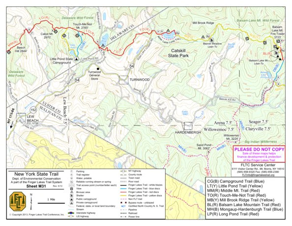
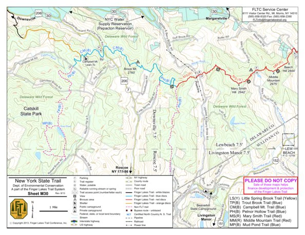
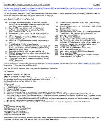
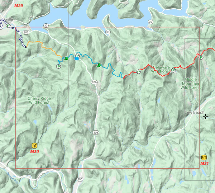
Map "M30 - Delaware Wild Forest" shows the FLT Main trail in Delaware County from Campbell Brook Rd & Campbell Mountain Rd to Beech Hill Rd.
Revised on: Aug 1, 2013
Check Trail Conditions: https://fingerlakestrail.org/plan-hikes-finger-lakes-trail/trail-conditions/?show=M30
== PUBLIC LANDS HOSTING THE TRAIL ==
* Delaware Wild Forest
* Middle Mountain Wild Forest
* Balsam Lake Mountain Wild Forest
== PLACE NAMES NEAR THE TRAIL ==
* Downsville
* Pepacton Reservoir
* Roscoe
___________
The Finger Lakes Trail System includes the Main Trail of the Finger Lakes Trail (FLT) from the Pennsylvania-New York border in Allegany State Park to the Long Path at Slide Mountain summit in the Catskill Forest Preserve. The Main Trail of the FLT is over 550 miles long of which approximately 450 miles are the track of the North Country National Scenic Trail (NCNST). There are six branch trails and 29 loop and spur trails that extend from the Main FLT. These branch, loop and spur trails currently total over 400 miles and link to Niagara Falls, Letchworth State Park, the Great Eastern Trail in Pennsylvania, the Finger Lakes National Forest, and the Bristol Hills section of the Finger Lakes region. Including the Main Trail and all branch, loop, and side trails, the Finger Lakes Trail System offers over 1,000 miles of hiking.
The Finger Lakes Trail was built and is maintained by volunteers. Each year, volunteers log in approximately 20,000 hours of trail work. But trail work alone does not keep the organization going. There are many other tasks performed by volunteers to support the organization and provide services to our members, our partners, and the general public.
The FLTC publishes 66 high quality, waterproof paper maps and 66 downloadable digital map files of the Finger Lakes Trail system. You can purchase these maps, learn more about the trail and organization, find volunteer opportunities, and participate in exciting hiking programs by visiting our website: fingerlakestrail.org
Product Information
Product Information
Shipping & Returns
Shipping & Returns
M30 – Delaware Wild Forest
M30 – Delaware Wild Forest
Map "M30 - Delaware Wild Forest" shows the FLT Main trail in Delaware County from Campbell Brook Rd & Campbell Mountain Rd to Beech Hill Rd.
Revised on: Aug 1, 2013
Check Trail Conditions: https://fingerlakestrail.org/plan-hikes-finger-lakes-trail/trail-conditions/?show=M30
== PUBLIC LANDS HOSTING THE TRAIL ==
* Delaware Wild Forest
* Middle Mountain Wild Forest
* Balsam Lake Mountain Wild Forest
== PLACE NAMES NEAR THE TRAIL ==
* Downsville
* Pepacton Reservoir
* Roscoe
___________
The Finger Lakes Trail System includes the Main Trail of the Finger Lakes Trail (FLT) from the Pennsylvania-New York border in Allegany State Park to the Long Path at Slide Mountain summit in the Catskill Forest Preserve. The Main Trail of the FLT is over 550 miles long of which approximately 450 miles are the track of the North Country National Scenic Trail (NCNST). There are six branch trails and 29 loop and spur trails that extend from the Main FLT. These branch, loop and spur trails currently total over 400 miles and link to Niagara Falls, Letchworth State Park, the Great Eastern Trail in Pennsylvania, the Finger Lakes National Forest, and the Bristol Hills section of the Finger Lakes region. Including the Main Trail and all branch, loop, and side trails, the Finger Lakes Trail System offers over 1,000 miles of hiking.
The Finger Lakes Trail was built and is maintained by volunteers. Each year, volunteers log in approximately 20,000 hours of trail work. But trail work alone does not keep the organization going. There are many other tasks performed by volunteers to support the organization and provide services to our members, our partners, and the general public.
The FLTC publishes 66 high quality, waterproof paper maps and 66 downloadable digital map files of the Finger Lakes Trail system. You can purchase these maps, learn more about the trail and organization, find volunteer opportunities, and participate in exciting hiking programs by visiting our website: fingerlakestrail.org
$4.99
M30 – Delaware Wild Forest—
$4.99
Product Information
Product Information
Shipping & Returns
Shipping & Returns
Description
Map "M30 - Delaware Wild Forest" shows the FLT Main trail in Delaware County from Campbell Brook Rd & Campbell Mountain Rd to Beech Hill Rd.
Revised on: Aug 1, 2013
Check Trail Conditions: https://fingerlakestrail.org/plan-hikes-finger-lakes-trail/trail-conditions/?show=M30
== PUBLIC LANDS HOSTING THE TRAIL ==
* Delaware Wild Forest
* Middle Mountain Wild Forest
* Balsam Lake Mountain Wild Forest
== PLACE NAMES NEAR THE TRAIL ==
* Downsville
* Pepacton Reservoir
* Roscoe
___________
The Finger Lakes Trail System includes the Main Trail of the Finger Lakes Trail (FLT) from the Pennsylvania-New York border in Allegany State Park to the Long Path at Slide Mountain summit in the Catskill Forest Preserve. The Main Trail of the FLT is over 550 miles long of which approximately 450 miles are the track of the North Country National Scenic Trail (NCNST). There are six branch trails and 29 loop and spur trails that extend from the Main FLT. These branch, loop and spur trails currently total over 400 miles and link to Niagara Falls, Letchworth State Park, the Great Eastern Trail in Pennsylvania, the Finger Lakes National Forest, and the Bristol Hills section of the Finger Lakes region. Including the Main Trail and all branch, loop, and side trails, the Finger Lakes Trail System offers over 1,000 miles of hiking.
The Finger Lakes Trail was built and is maintained by volunteers. Each year, volunteers log in approximately 20,000 hours of trail work. But trail work alone does not keep the organization going. There are many other tasks performed by volunteers to support the organization and provide services to our members, our partners, and the general public.
The FLTC publishes 66 high quality, waterproof paper maps and 66 downloadable digital map files of the Finger Lakes Trail system. You can purchase these maps, learn more about the trail and organization, find volunteer opportunities, and participate in exciting hiking programs by visiting our website: fingerlakestrail.org