🎉 Up to 70% Off Selected ItemsShop Sale
Algonquin Provincial Park - Overview Park Map 7th ed
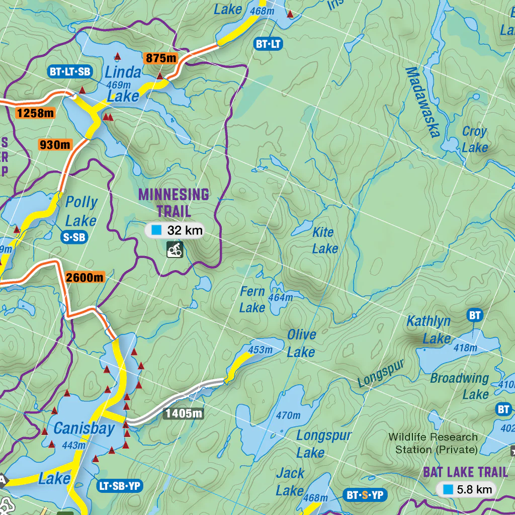
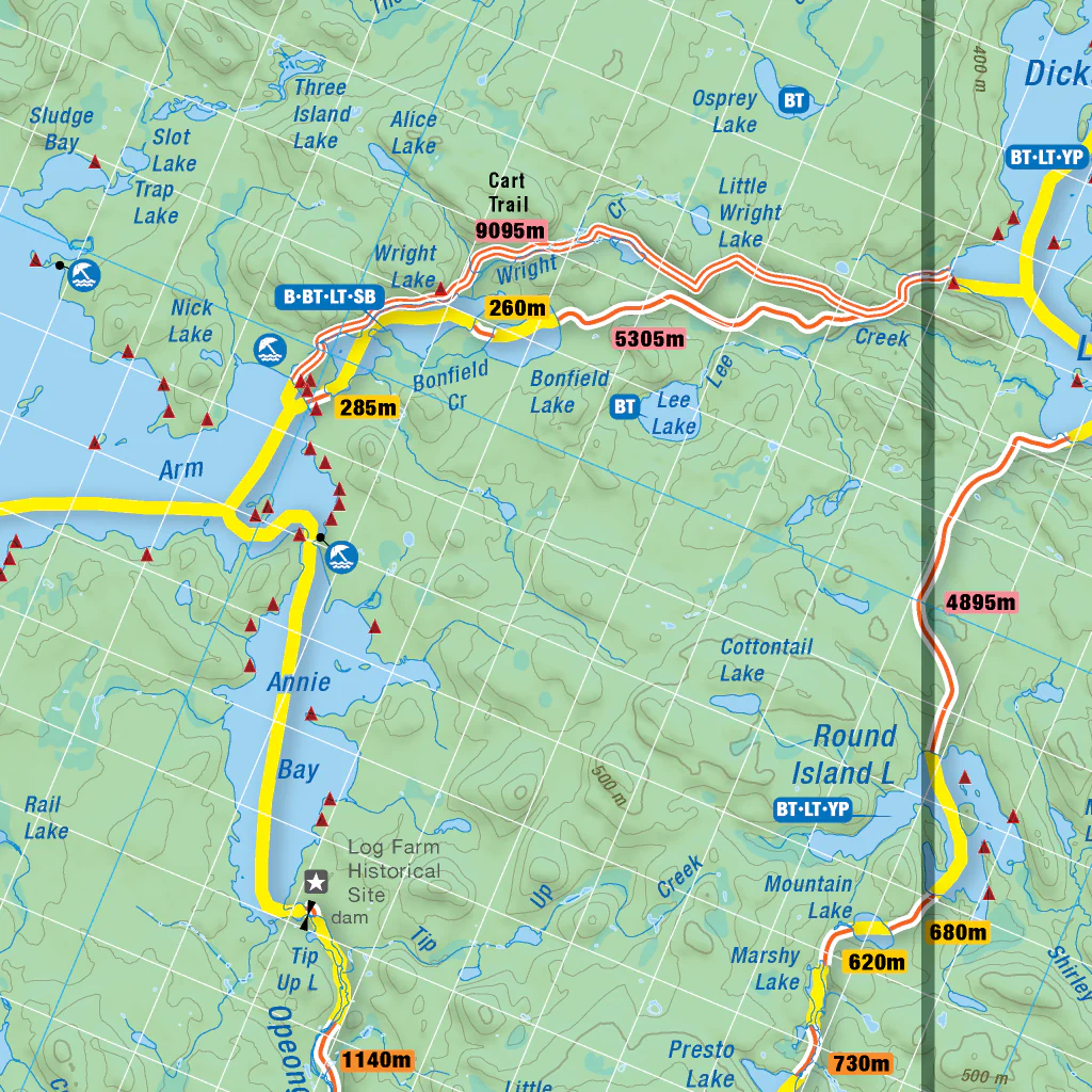
This recreation map for Algonquin Provincial Park highlights all the canoe routes, hiking and backpacking trails, fishing lakes and streams, frontcountry and backcountry campsites, cross-country ski and snowshoe trails, canoe access points, portage trails, wildlife viewing areas and more. This map bundle covers the entire park at 1:140,000 scale, covering an area of 7,653 square km (2,955 square miles).
Special features include labelled fish species, canoe access points, portages with distances, backcountry campsites, enhanced canoe and hiking routes, crown land and more. Designed to help you make the most out of your Algonquin Park adventure, you won’t find a map with more recreational opportunities anywhere.
Featuring our industry-leading topographic relief and shading, these maps cover Achray, Aylen Lake, Barron Canyon, Barry’s Bay, Basin Depot, Bonnechere River, Brent, Canoe Lake, Eastern Pines Trail, East Gate, Grand Lake, Kingscote, Kiosk, Lake of Two Rivers, Lake Travers, Madawaska, Opeongo Lake, Petawawa River, Rock Lake, Smoke Lake, Western Uplands Backpacking Trail, West Gate, Whitney and more!
For the App version
www.brmbmaps.com
For a waterproof printed version of the map visit
www.backroadmapbooks.com
Product Information
Product Information
Shipping & Returns
Shipping & Returns


Algonquin Provincial Park - Overview Park Map 7th ed
Algonquin Provincial Park - Overview Park Map 7th ed
This recreation map for Algonquin Provincial Park highlights all the canoe routes, hiking and backpacking trails, fishing lakes and streams, frontcountry and backcountry campsites, cross-country ski and snowshoe trails, canoe access points, portage trails, wildlife viewing areas and more. This map bundle covers the entire park at 1:140,000 scale, covering an area of 7,653 square km (2,955 square miles).
Special features include labelled fish species, canoe access points, portages with distances, backcountry campsites, enhanced canoe and hiking routes, crown land and more. Designed to help you make the most out of your Algonquin Park adventure, you won’t find a map with more recreational opportunities anywhere.
Featuring our industry-leading topographic relief and shading, these maps cover Achray, Aylen Lake, Barron Canyon, Barry’s Bay, Basin Depot, Bonnechere River, Brent, Canoe Lake, Eastern Pines Trail, East Gate, Grand Lake, Kingscote, Kiosk, Lake of Two Rivers, Lake Travers, Madawaska, Opeongo Lake, Petawawa River, Rock Lake, Smoke Lake, Western Uplands Backpacking Trail, West Gate, Whitney and more!
For the App version
www.brmbmaps.com
For a waterproof printed version of the map visit
www.backroadmapbooks.com
$3.50
Original: $9.99
-65%Algonquin Provincial Park - Overview Park Map 7th ed—
$9.99
$3.50Product Information
Product Information
Shipping & Returns
Shipping & Returns
Description
This recreation map for Algonquin Provincial Park highlights all the canoe routes, hiking and backpacking trails, fishing lakes and streams, frontcountry and backcountry campsites, cross-country ski and snowshoe trails, canoe access points, portage trails, wildlife viewing areas and more. This map bundle covers the entire park at 1:140,000 scale, covering an area of 7,653 square km (2,955 square miles).
Special features include labelled fish species, canoe access points, portages with distances, backcountry campsites, enhanced canoe and hiking routes, crown land and more. Designed to help you make the most out of your Algonquin Park adventure, you won’t find a map with more recreational opportunities anywhere.
Featuring our industry-leading topographic relief and shading, these maps cover Achray, Aylen Lake, Barron Canyon, Barry’s Bay, Basin Depot, Bonnechere River, Brent, Canoe Lake, Eastern Pines Trail, East Gate, Grand Lake, Kingscote, Kiosk, Lake of Two Rivers, Lake Travers, Madawaska, Opeongo Lake, Petawawa River, Rock Lake, Smoke Lake, Western Uplands Backpacking Trail, West Gate, Whitney and more!
For the App version
www.brmbmaps.com
For a waterproof printed version of the map visit
www.backroadmapbooks.com