🎉 Up to 70% Off Selected ItemsShop Sale
Battenkill River Fishing Map - Fish New York
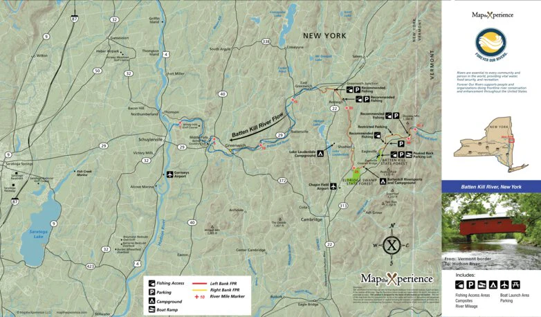
The Battenkill River Fishing Map is designed to give anglers a clear, detailed understanding of one of the Northeast’s most historic and technically demanding trout rivers. Flowing from the Green Mountains of Vermont into eastern New York before joining the Hudson River, the Battenkill is a low-gradient, spring-influenced freestone river famous for its clear water, fertile insect life, and exceptionally selective trout. The river supports strong populations of wild brown trout, along with stocked and holdover fish, offering classic dry-fly fishing from spring through fall.
https://mapthexperience.com/collections/paper-maps
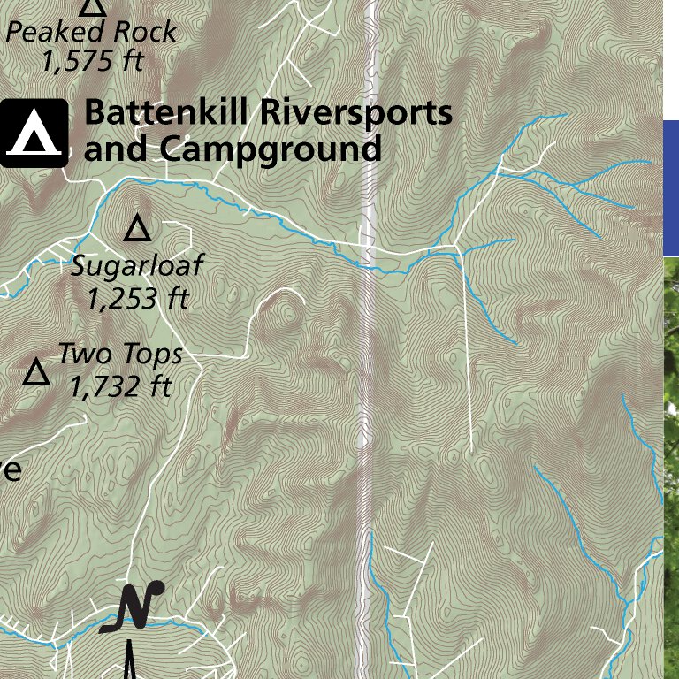
This map highlights the Battenkill’s most productive and well-known sections within New York, including meadow stretches, wooded runs, and classic riffle-pool sequences that define the river’s character. Public land boundaries are clearly marked for legal and confident access, along with carefully researched access points and exclusive parking locations found on no other maps—helping anglers plan efficient days on the water while navigating a corridor that includes significant private land.
The Battenkill is primarily a walk-and-wade fishery. Its narrow channel, low gradient, and shallow riffles make floating uncommon and impractical for anglers. This map is built specifically for wading anglers, emphasizing subtle river structure, seams, depth changes, and holding water that are critical for successfully fishing this technical river.
Detailed insect hatch charts reflect the Battenkill’s renowned insect life, including Hendricksons, sulphurs, BWOs, caddis, and midges, which fuel legendary dry-fly fishing. Light tippet, precise presentations, and careful approach are often required, with nymphing effective during non-hatch periods. Whether you’re stalking rising trout in smooth glides, fishing classic riffles, or working shaded banks through meadow stretches, this map provides the practical, field-ready information needed to fish the Battenkill River with confidence.
Product Information
Product Information
Shipping & Returns
Shipping & Returns
Battenkill River Fishing Map - Fish New York
Battenkill River Fishing Map - Fish New York
The Battenkill River Fishing Map is designed to give anglers a clear, detailed understanding of one of the Northeast’s most historic and technically demanding trout rivers. Flowing from the Green Mountains of Vermont into eastern New York before joining the Hudson River, the Battenkill is a low-gradient, spring-influenced freestone river famous for its clear water, fertile insect life, and exceptionally selective trout. The river supports strong populations of wild brown trout, along with stocked and holdover fish, offering classic dry-fly fishing from spring through fall.
https://mapthexperience.com/collections/paper-maps
This map highlights the Battenkill’s most productive and well-known sections within New York, including meadow stretches, wooded runs, and classic riffle-pool sequences that define the river’s character. Public land boundaries are clearly marked for legal and confident access, along with carefully researched access points and exclusive parking locations found on no other maps—helping anglers plan efficient days on the water while navigating a corridor that includes significant private land.
The Battenkill is primarily a walk-and-wade fishery. Its narrow channel, low gradient, and shallow riffles make floating uncommon and impractical for anglers. This map is built specifically for wading anglers, emphasizing subtle river structure, seams, depth changes, and holding water that are critical for successfully fishing this technical river.
Detailed insect hatch charts reflect the Battenkill’s renowned insect life, including Hendricksons, sulphurs, BWOs, caddis, and midges, which fuel legendary dry-fly fishing. Light tippet, precise presentations, and careful approach are often required, with nymphing effective during non-hatch periods. Whether you’re stalking rising trout in smooth glides, fishing classic riffles, or working shaded banks through meadow stretches, this map provides the practical, field-ready information needed to fish the Battenkill River with confidence.
$4.99
Battenkill River Fishing Map - Fish New York—
$4.99
Product Information
Product Information
Shipping & Returns
Shipping & Returns
Description
The Battenkill River Fishing Map is designed to give anglers a clear, detailed understanding of one of the Northeast’s most historic and technically demanding trout rivers. Flowing from the Green Mountains of Vermont into eastern New York before joining the Hudson River, the Battenkill is a low-gradient, spring-influenced freestone river famous for its clear water, fertile insect life, and exceptionally selective trout. The river supports strong populations of wild brown trout, along with stocked and holdover fish, offering classic dry-fly fishing from spring through fall.
https://mapthexperience.com/collections/paper-maps
This map highlights the Battenkill’s most productive and well-known sections within New York, including meadow stretches, wooded runs, and classic riffle-pool sequences that define the river’s character. Public land boundaries are clearly marked for legal and confident access, along with carefully researched access points and exclusive parking locations found on no other maps—helping anglers plan efficient days on the water while navigating a corridor that includes significant private land.
The Battenkill is primarily a walk-and-wade fishery. Its narrow channel, low gradient, and shallow riffles make floating uncommon and impractical for anglers. This map is built specifically for wading anglers, emphasizing subtle river structure, seams, depth changes, and holding water that are critical for successfully fishing this technical river.
Detailed insect hatch charts reflect the Battenkill’s renowned insect life, including Hendricksons, sulphurs, BWOs, caddis, and midges, which fuel legendary dry-fly fishing. Light tippet, precise presentations, and careful approach are often required, with nymphing effective during non-hatch periods. Whether you’re stalking rising trout in smooth glides, fishing classic riffles, or working shaded banks through meadow stretches, this map provides the practical, field-ready information needed to fish the Battenkill River with confidence.