🎉 Up to 70% Off Selected ItemsShop Sale
Behind The Rocks Trail - Rated 7
The area known as "Behind the Rocks" consists of elevated terrain south of Moab, bordered approximately by the Moab Rim cliffs and the edge of Kane Springs Canyon farther to the south and west. This route follows the most demanding path among several in the region, gaining its reputation and elevated difficulty primarily from White Knuckle Hill. Descending the hill presents significant challenges, while ascending it often involves extended delays and demonstrations of skill. It stands as one of the toughest inclines in the vicinity regularly attempted, though attempts have decreased as erosion progresses.
Scenery
Rock formations slope downward beyond the Moab Rim, with a dense expanse of Navajo Sandstone domes and fins visible throughout much of the journey. Various canyons, such as Hunters Canyon, carve into underlying strata. Notable features include Balcony Arch, Picture Frame Arch, and a remote glimpse of Pritchett Arch.
Surface
The majority of the path comprises sandy dirt interspersed with rock exposures. Crossing numerous small canyons involves rough travel over sandstone outcrops.
Trail Details
An initial ascent serves as preparation shortly after departing the highway, followed by various minor canyon traversals leading to High-Dive Canyon. This steep, rugged drop lies a brief distance upstream from a high pour-off into a scenic pool. Exiting the minor canyon offers options: a challenging ledge or the demanding "Upchuck Hill." Several engaging miles later, White Knuckle Hill drops via large steps from an upper plateau to a lower level.
Length: 55 total, 35 off-highway
Min Tire Size: 35+ inches
Winch: No
Front Locker: Yes
Rear Locker: Yes
Product Information
Product Information
Shipping & Returns
Shipping & Returns

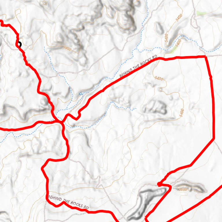

Behind The Rocks Trail - Rated 7
Behind The Rocks Trail - Rated 7
The area known as "Behind the Rocks" consists of elevated terrain south of Moab, bordered approximately by the Moab Rim cliffs and the edge of Kane Springs Canyon farther to the south and west. This route follows the most demanding path among several in the region, gaining its reputation and elevated difficulty primarily from White Knuckle Hill. Descending the hill presents significant challenges, while ascending it often involves extended delays and demonstrations of skill. It stands as one of the toughest inclines in the vicinity regularly attempted, though attempts have decreased as erosion progresses.
Scenery
Rock formations slope downward beyond the Moab Rim, with a dense expanse of Navajo Sandstone domes and fins visible throughout much of the journey. Various canyons, such as Hunters Canyon, carve into underlying strata. Notable features include Balcony Arch, Picture Frame Arch, and a remote glimpse of Pritchett Arch.
Surface
The majority of the path comprises sandy dirt interspersed with rock exposures. Crossing numerous small canyons involves rough travel over sandstone outcrops.
Trail Details
An initial ascent serves as preparation shortly after departing the highway, followed by various minor canyon traversals leading to High-Dive Canyon. This steep, rugged drop lies a brief distance upstream from a high pour-off into a scenic pool. Exiting the minor canyon offers options: a challenging ledge or the demanding "Upchuck Hill." Several engaging miles later, White Knuckle Hill drops via large steps from an upper plateau to a lower level.
Length: 55 total, 35 off-highway
Min Tire Size: 35+ inches
Winch: No
Front Locker: Yes
Rear Locker: Yes
$1.99
Behind The Rocks Trail - Rated 7—
$1.99
Product Information
Product Information
Shipping & Returns
Shipping & Returns
Description
The area known as "Behind the Rocks" consists of elevated terrain south of Moab, bordered approximately by the Moab Rim cliffs and the edge of Kane Springs Canyon farther to the south and west. This route follows the most demanding path among several in the region, gaining its reputation and elevated difficulty primarily from White Knuckle Hill. Descending the hill presents significant challenges, while ascending it often involves extended delays and demonstrations of skill. It stands as one of the toughest inclines in the vicinity regularly attempted, though attempts have decreased as erosion progresses.
Scenery
Rock formations slope downward beyond the Moab Rim, with a dense expanse of Navajo Sandstone domes and fins visible throughout much of the journey. Various canyons, such as Hunters Canyon, carve into underlying strata. Notable features include Balcony Arch, Picture Frame Arch, and a remote glimpse of Pritchett Arch.
Surface
The majority of the path comprises sandy dirt interspersed with rock exposures. Crossing numerous small canyons involves rough travel over sandstone outcrops.
Trail Details
An initial ascent serves as preparation shortly after departing the highway, followed by various minor canyon traversals leading to High-Dive Canyon. This steep, rugged drop lies a brief distance upstream from a high pour-off into a scenic pool. Exiting the minor canyon offers options: a challenging ledge or the demanding "Upchuck Hill." Several engaging miles later, White Knuckle Hill drops via large steps from an upper plateau to a lower level.
Length: 55 total, 35 off-highway
Min Tire Size: 35+ inches
Winch: No
Front Locker: Yes
Rear Locker: Yes