🎉 Up to 70% Off Selected ItemsShop Sale
Devils Racetrack - Rated 5
Located ~40 miles west of Green River, UT (51-mile drive from Moab). Fuel up in Green River (limited services beyond town). The 34-mile trail departs from the West Main Street Maverik in Green River at 8:00 a.m.; plan arrival from lodging accordingly.
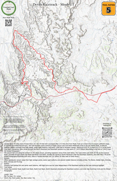
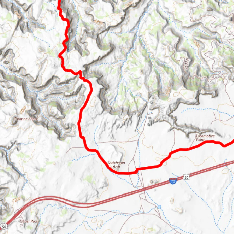
Route enters just north of I-70 via Eva Conover Road, follows South Coal Wash and North Coal Wash, traverses the signature Devil's Racetrack (including the Razorback obstacle), and exits near I-70 at the Sinbad Pictographs/Dutchman Arch area (close to Temple Mountain exit 131, ~30 miles west of Green River).
Scenery
Traverses Eagle Canyon and Coal Wash Wilderness areas in the San Rafael Swell. Mixes high-mesa canyon overlooks with sandy wash bottoms. Features ~3,000 ft elevation change: starts at 6,911 ft, drops to 5,771 ft at North Coal Wash intersection, climbs through Devil's Racetrack/Razorback to 7,163 ft, then descends to exit at 7,044 ft near pictographs. Second half runs along vertical canyon rim with expansive views of the wash below. Watch for arches and named features: The Blocks, Golden Gate, Chimney Rock, Joe and His Dog.
Surface
Mostly hard-packed dirt and sandy wash bottoms, with tight turns and the rocky ledges/steps of the Razorback section as the primary technical highlight. Full round-trip includes ~70 miles of interstate travel; vehicle must handle sustained 65–70 mph highway speeds.
Trail Details
Covers Eva Conover Road, South Coal Wash, North Coal Wash, Devil's Racetrack (with Razorback obstacle), Dutchman Arch, and Sinbad Pictographs.
Length: 100 pavement, 34 off-road
Min Tire Size: 33+ inches
Winch: No
Front Locker: No
Rear Locker: Yes
Product Information
Product Information
Shipping & Returns
Shipping & Returns
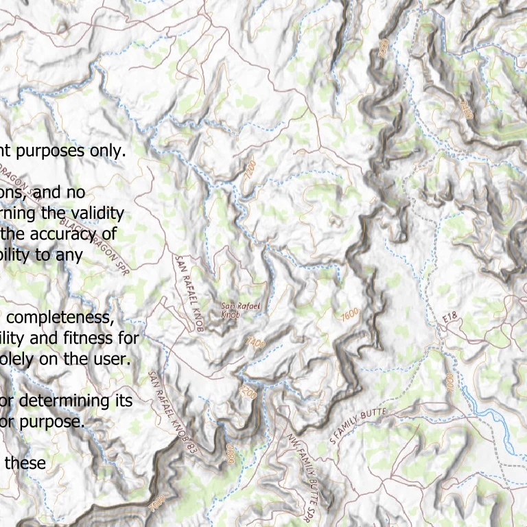
Devils Racetrack - Rated 5
Devils Racetrack - Rated 5
Located ~40 miles west of Green River, UT (51-mile drive from Moab). Fuel up in Green River (limited services beyond town). The 34-mile trail departs from the West Main Street Maverik in Green River at 8:00 a.m.; plan arrival from lodging accordingly.
Route enters just north of I-70 via Eva Conover Road, follows South Coal Wash and North Coal Wash, traverses the signature Devil's Racetrack (including the Razorback obstacle), and exits near I-70 at the Sinbad Pictographs/Dutchman Arch area (close to Temple Mountain exit 131, ~30 miles west of Green River).
Scenery
Traverses Eagle Canyon and Coal Wash Wilderness areas in the San Rafael Swell. Mixes high-mesa canyon overlooks with sandy wash bottoms. Features ~3,000 ft elevation change: starts at 6,911 ft, drops to 5,771 ft at North Coal Wash intersection, climbs through Devil's Racetrack/Razorback to 7,163 ft, then descends to exit at 7,044 ft near pictographs. Second half runs along vertical canyon rim with expansive views of the wash below. Watch for arches and named features: The Blocks, Golden Gate, Chimney Rock, Joe and His Dog.
Surface
Mostly hard-packed dirt and sandy wash bottoms, with tight turns and the rocky ledges/steps of the Razorback section as the primary technical highlight. Full round-trip includes ~70 miles of interstate travel; vehicle must handle sustained 65–70 mph highway speeds.
Trail Details
Covers Eva Conover Road, South Coal Wash, North Coal Wash, Devil's Racetrack (with Razorback obstacle), Dutchman Arch, and Sinbad Pictographs.
Length: 100 pavement, 34 off-road
Min Tire Size: 33+ inches
Winch: No
Front Locker: No
Rear Locker: Yes
$0.70
Original: $1.99
-65%Devils Racetrack - Rated 5—
$1.99
$0.70Product Information
Product Information
Shipping & Returns
Shipping & Returns
Description
Located ~40 miles west of Green River, UT (51-mile drive from Moab). Fuel up in Green River (limited services beyond town). The 34-mile trail departs from the West Main Street Maverik in Green River at 8:00 a.m.; plan arrival from lodging accordingly.
Route enters just north of I-70 via Eva Conover Road, follows South Coal Wash and North Coal Wash, traverses the signature Devil's Racetrack (including the Razorback obstacle), and exits near I-70 at the Sinbad Pictographs/Dutchman Arch area (close to Temple Mountain exit 131, ~30 miles west of Green River).
Scenery
Traverses Eagle Canyon and Coal Wash Wilderness areas in the San Rafael Swell. Mixes high-mesa canyon overlooks with sandy wash bottoms. Features ~3,000 ft elevation change: starts at 6,911 ft, drops to 5,771 ft at North Coal Wash intersection, climbs through Devil's Racetrack/Razorback to 7,163 ft, then descends to exit at 7,044 ft near pictographs. Second half runs along vertical canyon rim with expansive views of the wash below. Watch for arches and named features: The Blocks, Golden Gate, Chimney Rock, Joe and His Dog.
Surface
Mostly hard-packed dirt and sandy wash bottoms, with tight turns and the rocky ledges/steps of the Razorback section as the primary technical highlight. Full round-trip includes ~70 miles of interstate travel; vehicle must handle sustained 65–70 mph highway speeds.
Trail Details
Covers Eva Conover Road, South Coal Wash, North Coal Wash, Devil's Racetrack (with Razorback obstacle), Dutchman Arch, and Sinbad Pictographs.
Length: 100 pavement, 34 off-road
Min Tire Size: 33+ inches
Winch: No
Front Locker: No
Rear Locker: Yes