🎉 Up to 70% Off Selected ItemsShop Sale
Mesquite to Caliente OHV Network - Nevada
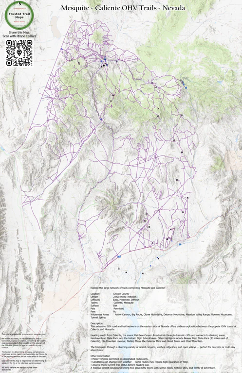
Explore this large network of trails connecting Mesquite and Caliente!
Location Lincoln County
Length 2,000 miles (Network)
Difficulty Easy, Moderate, Difficult
Towns Caliente, Mesquite
Surface Dirt
Pets Permitted
Fees No
Wilderness Areas
Arrow Canyon, Big Rocks, Clover Mountains, Delamar Mountains, Meadow Valley Range, Mormon Mountains, Tunnel Spring
Description
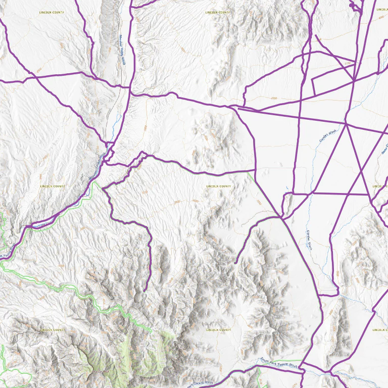
Stretching across eastern Lincoln County, this vast BLM trail network connects the two popular OHV destinations of Caliente and Mesquite with over 2,000 miles of roads and trails. Riders can enjoy everything from easy valley runs to more challenging backcountry routes through dramatic desert landscapes.
From Caliente, the beautiful Rainbow Canyon Road heads south through striking cliffs and leads to popular spots like Kershaw-Ryan State Park and the historic Elgin Schoolhouse. Other worthwhile destinations include Beaver Dam State Park just east of town, Ella Mountain Lookout, Flattop Mesa, the Delamar Mine and Ghost Town, and Chief Mountain.
The trails traverse a spectacular mix of terrain — rugged canyons, open washes, forested ridges, and wide sagebrush valleys — giving riders plenty of variety and scenery.
Ecological Highlights
Along Route 317 between Mesquite and Caliente, you’ll follow the Meadow Valley Wash. This intermittently flowing waterway creates lush oases in places fed by springs and is home to the rare Meadow Valley Speckled Dace — a tiny fish found nowhere else on Earth. The wash also supports other special species like Arizona Toads and Southwestern Willow Flycatchers.
Other Information
Motor vehicles are permitted on designated routes only. Trail conditions can vary significantly with weather, so high-clearance or 4WD vehicles are often recommended. Always plan ahead and check with local land managers for current conditions.
For more detailed suggested loops, see the Caliente Area Suggested OHV Trails posting or explore other nearby areas on Off-Road Nevada.
A fantastic desert OHV network that links two great towns with history, scenery, and endless riding possibilities.
Product Information
Product Information
Shipping & Returns
Shipping & Returns
Mesquite to Caliente OHV Network - Nevada
Mesquite to Caliente OHV Network - Nevada
Explore this large network of trails connecting Mesquite and Caliente!
Location Lincoln County
Length 2,000 miles (Network)
Difficulty Easy, Moderate, Difficult
Towns Caliente, Mesquite
Surface Dirt
Pets Permitted
Fees No
Wilderness Areas
Arrow Canyon, Big Rocks, Clover Mountains, Delamar Mountains, Meadow Valley Range, Mormon Mountains, Tunnel Spring
Description
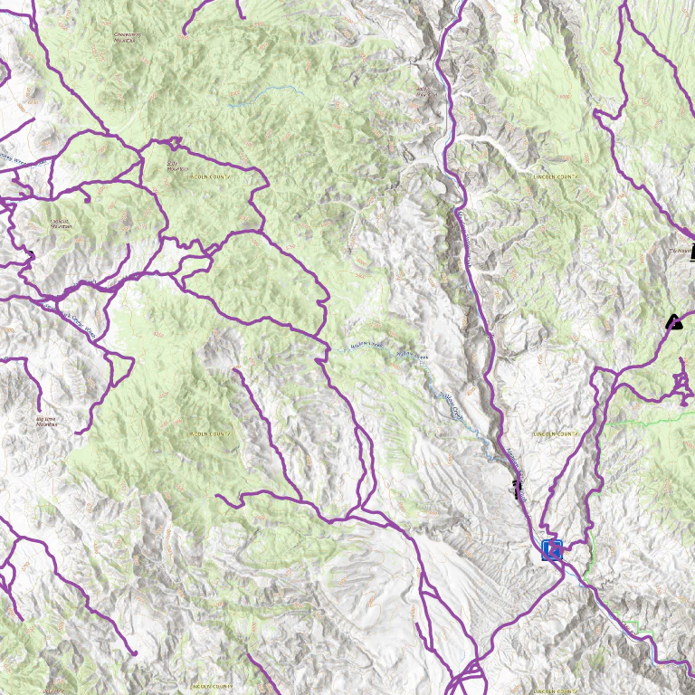
Stretching across eastern Lincoln County, this vast BLM trail network connects the two popular OHV destinations of Caliente and Mesquite with over 2,000 miles of roads and trails. Riders can enjoy everything from easy valley runs to more challenging backcountry routes through dramatic desert landscapes.
From Caliente, the beautiful Rainbow Canyon Road heads south through striking cliffs and leads to popular spots like Kershaw-Ryan State Park and the historic Elgin Schoolhouse. Other worthwhile destinations include Beaver Dam State Park just east of town, Ella Mountain Lookout, Flattop Mesa, the Delamar Mine and Ghost Town, and Chief Mountain.
The trails traverse a spectacular mix of terrain — rugged canyons, open washes, forested ridges, and wide sagebrush valleys — giving riders plenty of variety and scenery.
Ecological Highlights
Along Route 317 between Mesquite and Caliente, you’ll follow the Meadow Valley Wash. This intermittently flowing waterway creates lush oases in places fed by springs and is home to the rare Meadow Valley Speckled Dace — a tiny fish found nowhere else on Earth. The wash also supports other special species like Arizona Toads and Southwestern Willow Flycatchers.
Other Information
Motor vehicles are permitted on designated routes only. Trail conditions can vary significantly with weather, so high-clearance or 4WD vehicles are often recommended. Always plan ahead and check with local land managers for current conditions.
For more detailed suggested loops, see the Caliente Area Suggested OHV Trails posting or explore other nearby areas on Off-Road Nevada.
A fantastic desert OHV network that links two great towns with history, scenery, and endless riding possibilities.
$1.99
Mesquite to Caliente OHV Network - Nevada—
$1.99
Product Information
Product Information
Shipping & Returns
Shipping & Returns
Description
Explore this large network of trails connecting Mesquite and Caliente!
Location Lincoln County
Length 2,000 miles (Network)
Difficulty Easy, Moderate, Difficult
Towns Caliente, Mesquite
Surface Dirt
Pets Permitted
Fees No
Wilderness Areas
Arrow Canyon, Big Rocks, Clover Mountains, Delamar Mountains, Meadow Valley Range, Mormon Mountains, Tunnel Spring
Description
Stretching across eastern Lincoln County, this vast BLM trail network connects the two popular OHV destinations of Caliente and Mesquite with over 2,000 miles of roads and trails. Riders can enjoy everything from easy valley runs to more challenging backcountry routes through dramatic desert landscapes.
From Caliente, the beautiful Rainbow Canyon Road heads south through striking cliffs and leads to popular spots like Kershaw-Ryan State Park and the historic Elgin Schoolhouse. Other worthwhile destinations include Beaver Dam State Park just east of town, Ella Mountain Lookout, Flattop Mesa, the Delamar Mine and Ghost Town, and Chief Mountain.
The trails traverse a spectacular mix of terrain — rugged canyons, open washes, forested ridges, and wide sagebrush valleys — giving riders plenty of variety and scenery.
Ecological Highlights
Along Route 317 between Mesquite and Caliente, you’ll follow the Meadow Valley Wash. This intermittently flowing waterway creates lush oases in places fed by springs and is home to the rare Meadow Valley Speckled Dace — a tiny fish found nowhere else on Earth. The wash also supports other special species like Arizona Toads and Southwestern Willow Flycatchers.
Other Information
Motor vehicles are permitted on designated routes only. Trail conditions can vary significantly with weather, so high-clearance or 4WD vehicles are often recommended. Always plan ahead and check with local land managers for current conditions.
For more detailed suggested loops, see the Caliente Area Suggested OHV Trails posting or explore other nearby areas on Off-Road Nevada.
A fantastic desert OHV network that links two great towns with history, scenery, and endless riding possibilities.