🎉 Up to 70% Off Selected ItemsShop Sale
Oregon Winter Overland Adventure Route
This map is intended to give riders winter legal options for rides in the area border by approx. Paulina Lakes Road south to Crescent on the west and Ft. Rock on the east.
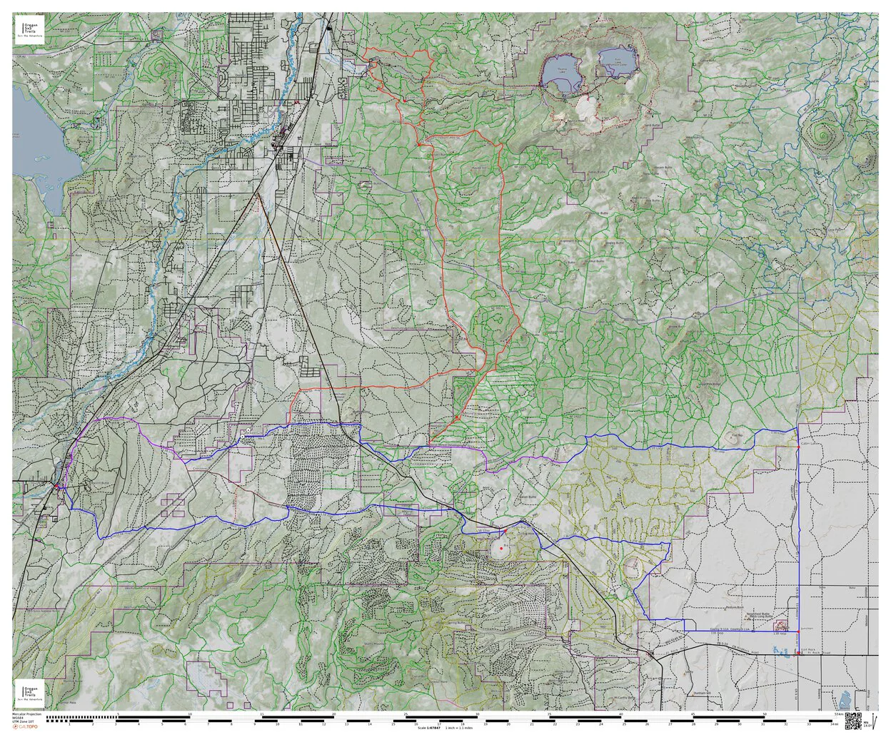
The blue route is a 138 loop from Crescent to Ft. Rock with another 56 mile leg shown in red to the Ogden Group Camp staging area. Included on the map is a MVUM overlay, the green dotted roads are open year around and the yellow dotted roads are closed Nov 30 thru April 30.
Expect snow, downed trees, washout, mud and more hazards.
Check with the local authorities before proceeding.
This map is offered as a suggested route, proceed at your own risk.
Product Information
Product Information
Shipping & Returns
Shipping & Returns


Oregon Winter Overland Adventure Route
Oregon Winter Overland Adventure Route
This map is intended to give riders winter legal options for rides in the area border by approx. Paulina Lakes Road south to Crescent on the west and Ft. Rock on the east.
The blue route is a 138 loop from Crescent to Ft. Rock with another 56 mile leg shown in red to the Ogden Group Camp staging area. Included on the map is a MVUM overlay, the green dotted roads are open year around and the yellow dotted roads are closed Nov 30 thru April 30.
Expect snow, downed trees, washout, mud and more hazards.
Check with the local authorities before proceeding.
This map is offered as a suggested route, proceed at your own risk.
$1.75
Original: $4.99
-65%Oregon Winter Overland Adventure Route—
$4.99
$1.75Product Information
Product Information
Shipping & Returns
Shipping & Returns
Description
This map is intended to give riders winter legal options for rides in the area border by approx. Paulina Lakes Road south to Crescent on the west and Ft. Rock on the east.
The blue route is a 138 loop from Crescent to Ft. Rock with another 56 mile leg shown in red to the Ogden Group Camp staging area. Included on the map is a MVUM overlay, the green dotted roads are open year around and the yellow dotted roads are closed Nov 30 thru April 30.
Expect snow, downed trees, washout, mud and more hazards.
Check with the local authorities before proceeding.
This map is offered as a suggested route, proceed at your own risk.