🎉 Up to 70% Off Selected ItemsShop Sale
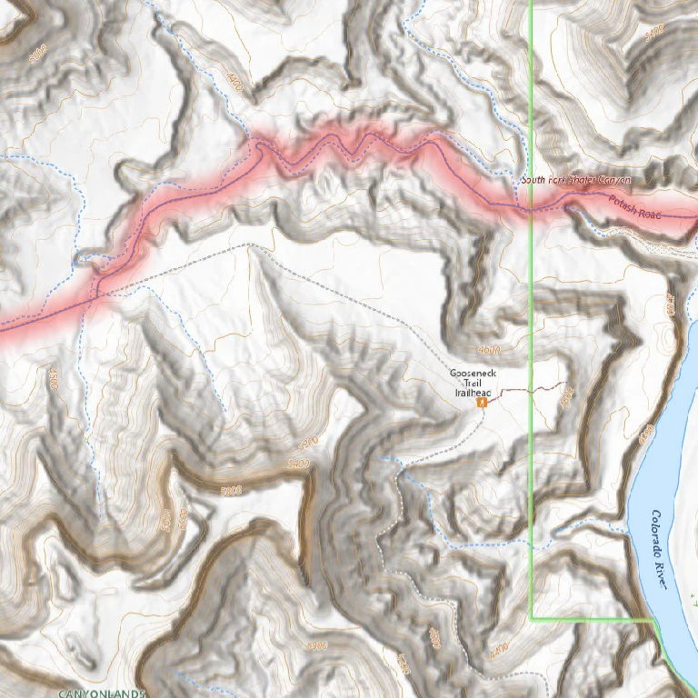
Potash Rd, Shafer Switchbacks - Moab UT
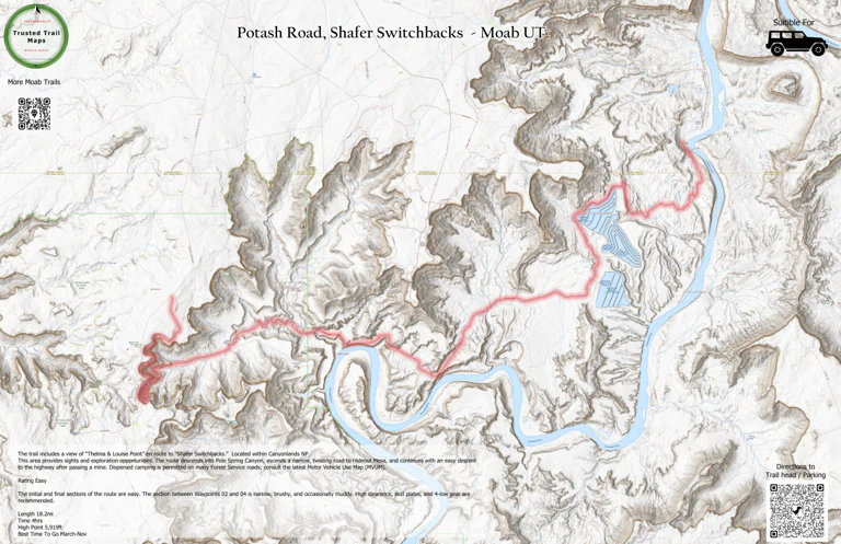
The trail includes a view of “Thelma & Louise Point” en route to “Shafer Switchbacks.” Located within Canyonlands NP.
This area provides sights and exploration opportunities. The route descends into Pole Spring Canyon, ascends a narrow, twisting road to Hideout Mesa, and continues with an easy descent to the highway after passing a mine. Dispersed camping is permitted on many Forest Service roads; consult the latest Motor Vehicle Use Map (MVUM).
Rating Easy
The initial and final sections of the route are easy. The section between Waypoints 02 and 04 is narrow, brushy, and occasionally muddy. High clearance, skid plates, and 4-low gear are recommended.
Length 18.2mi
Time 4hrs
High Point 5,919ft
Best Time To Go March-Nov
Product Information
Product Information
Shipping & Returns
Shipping & Returns
Potash Rd, Shafer Switchbacks - Moab UT
Potash Rd, Shafer Switchbacks - Moab UT
The trail includes a view of “Thelma & Louise Point” en route to “Shafer Switchbacks.” Located within Canyonlands NP.
This area provides sights and exploration opportunities. The route descends into Pole Spring Canyon, ascends a narrow, twisting road to Hideout Mesa, and continues with an easy descent to the highway after passing a mine. Dispersed camping is permitted on many Forest Service roads; consult the latest Motor Vehicle Use Map (MVUM).
Rating Easy
The initial and final sections of the route are easy. The section between Waypoints 02 and 04 is narrow, brushy, and occasionally muddy. High clearance, skid plates, and 4-low gear are recommended.
Length 18.2mi
Time 4hrs
High Point 5,919ft
Best Time To Go March-Nov
$1.99
Potash Rd, Shafer Switchbacks - Moab UT—
$1.99
Product Information
Product Information
Shipping & Returns
Shipping & Returns
Description
The trail includes a view of “Thelma & Louise Point” en route to “Shafer Switchbacks.” Located within Canyonlands NP.
This area provides sights and exploration opportunities. The route descends into Pole Spring Canyon, ascends a narrow, twisting road to Hideout Mesa, and continues with an easy descent to the highway after passing a mine. Dispersed camping is permitted on many Forest Service roads; consult the latest Motor Vehicle Use Map (MVUM).
Rating Easy
The initial and final sections of the route are easy. The section between Waypoints 02 and 04 is narrow, brushy, and occasionally muddy. High clearance, skid plates, and 4-low gear are recommended.
Length 18.2mi
Time 4hrs
High Point 5,919ft
Best Time To Go March-Nov