🎉 Up to 70% Off Selected ItemsShop Sale
Santa Cruz
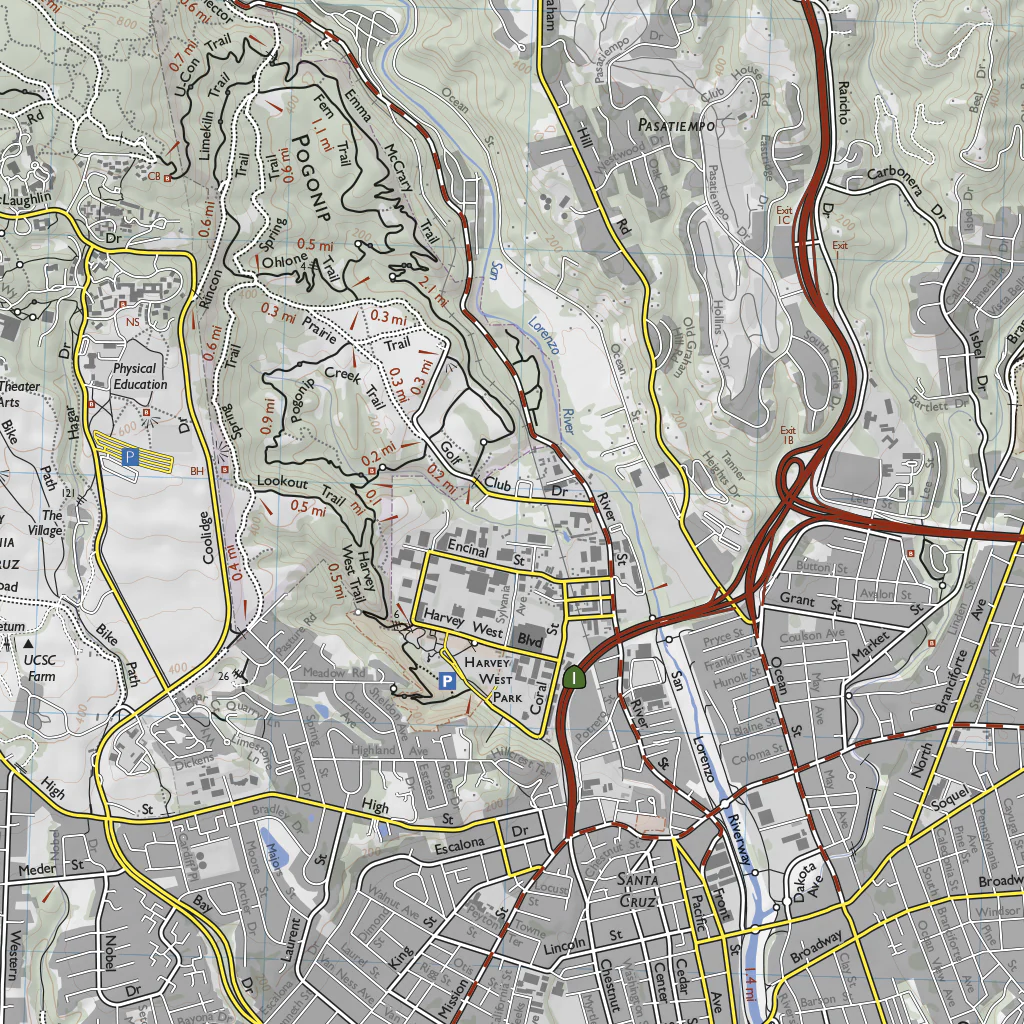
This trail map shows the Santa Cruz area. It's equivalent to the printed Henry Cowell, Wilder Ranch, and Nisene Marks map from Redwood Hikes Press, but both sides of the map and the area between them have been combined into a single large image. The map is 30 x 45 inches at a scale of 1:25,000.
The map shows Henry Cowell Redwoods State Park, the Forest of Nisene Marks State Park, Soquel Demonstration State Forest, the University of California at Santa Cruz, Wilder Ranch State Park, DeLaveaga Park, and Pogonip.
Official trails were drawn by hiking them with a GPS unit. Most roads are shown and labeled. Unofficial trails are also shown, and are greyed out to distinguish them from official hiking trails. Wooded areas are indicated in green, old growth redwoods in dark green, and developed areas in grey. 40 foot contour lines are shown, and trail distances are marked. Footbridges, scenic views, steps, and memorial grove markers are shown.
Update history:
December 2021: new trails in eastern half of Glenwood Preserve added.
June 2022: Ridge Trail in Fall Creek was rerouted. New Laguna Creek Trail added.
October 2025: Pogonip trails rerouted; Englesman/Long Meadow junction in Wilder Ranch moved.
Product Information
Product Information
Shipping & Returns
Shipping & Returns


Santa Cruz
Santa Cruz
This trail map shows the Santa Cruz area. It's equivalent to the printed Henry Cowell, Wilder Ranch, and Nisene Marks map from Redwood Hikes Press, but both sides of the map and the area between them have been combined into a single large image. The map is 30 x 45 inches at a scale of 1:25,000.
The map shows Henry Cowell Redwoods State Park, the Forest of Nisene Marks State Park, Soquel Demonstration State Forest, the University of California at Santa Cruz, Wilder Ranch State Park, DeLaveaga Park, and Pogonip.
Official trails were drawn by hiking them with a GPS unit. Most roads are shown and labeled. Unofficial trails are also shown, and are greyed out to distinguish them from official hiking trails. Wooded areas are indicated in green, old growth redwoods in dark green, and developed areas in grey. 40 foot contour lines are shown, and trail distances are marked. Footbridges, scenic views, steps, and memorial grove markers are shown.
Update history:
December 2021: new trails in eastern half of Glenwood Preserve added.
June 2022: Ridge Trail in Fall Creek was rerouted. New Laguna Creek Trail added.
October 2025: Pogonip trails rerouted; Englesman/Long Meadow junction in Wilder Ranch moved.
$1.75
Original: $4.99
-65%Santa Cruz—
$4.99
$1.75Product Information
Product Information
Shipping & Returns
Shipping & Returns
Description
This trail map shows the Santa Cruz area. It's equivalent to the printed Henry Cowell, Wilder Ranch, and Nisene Marks map from Redwood Hikes Press, but both sides of the map and the area between them have been combined into a single large image. The map is 30 x 45 inches at a scale of 1:25,000.
The map shows Henry Cowell Redwoods State Park, the Forest of Nisene Marks State Park, Soquel Demonstration State Forest, the University of California at Santa Cruz, Wilder Ranch State Park, DeLaveaga Park, and Pogonip.
Official trails were drawn by hiking them with a GPS unit. Most roads are shown and labeled. Unofficial trails are also shown, and are greyed out to distinguish them from official hiking trails. Wooded areas are indicated in green, old growth redwoods in dark green, and developed areas in grey. 40 foot contour lines are shown, and trail distances are marked. Footbridges, scenic views, steps, and memorial grove markers are shown.
Update history:
December 2021: new trails in eastern half of Glenwood Preserve added.
June 2022: Ridge Trail in Fall Creek was rerouted. New Laguna Creek Trail added.
October 2025: Pogonip trails rerouted; Englesman/Long Meadow junction in Wilder Ranch moved.

