🎉 Up to 70% Off Selected ItemsShop Sale
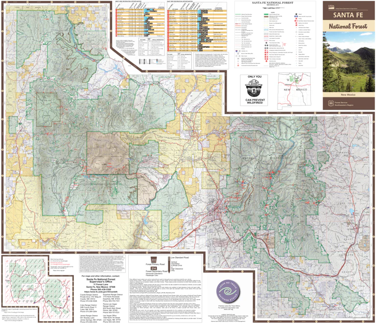
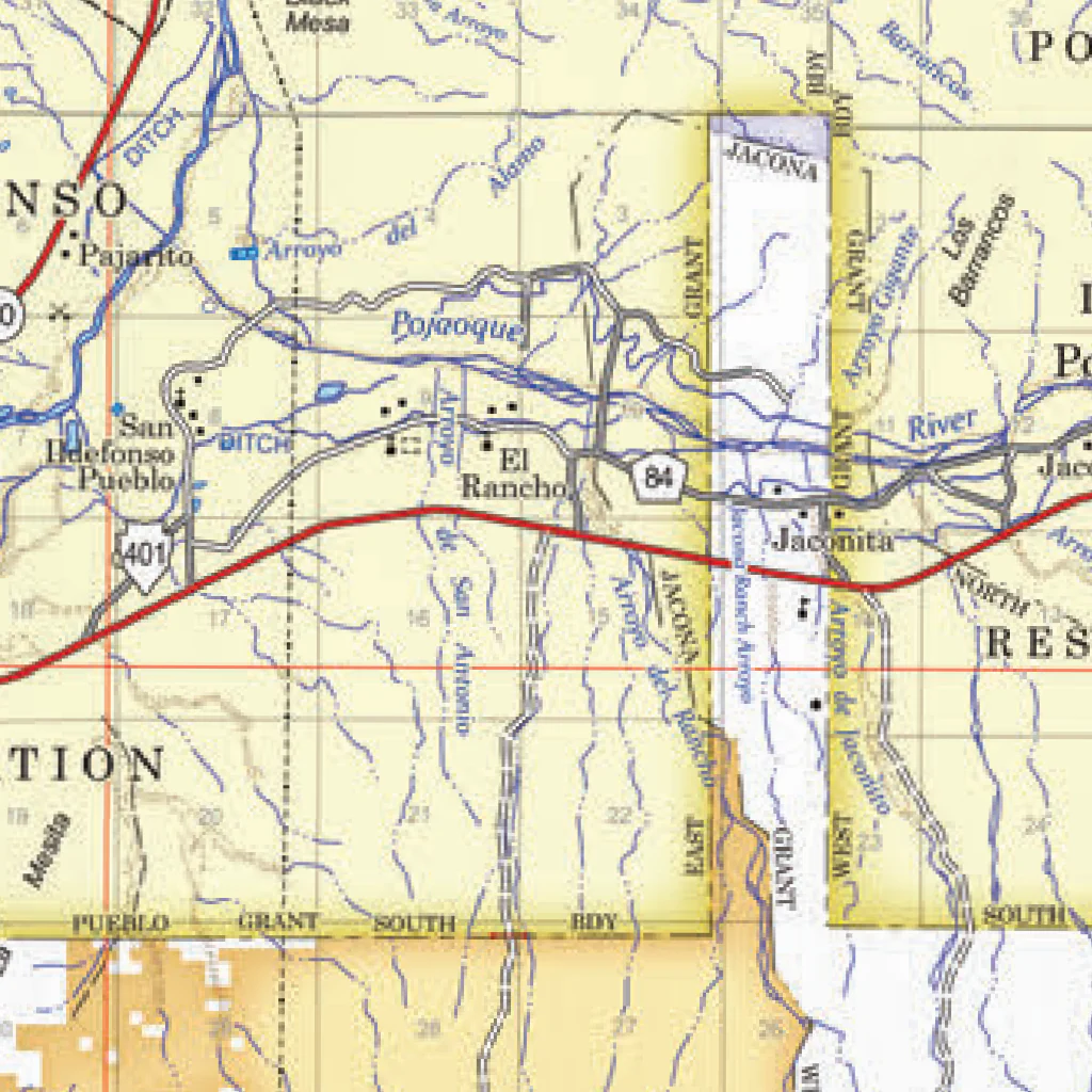
Santa Fe National Forest Visitor Map
Welcome To Santa Fe National Forest…
a land of high mountains rich in timber, wildlife, and forage.
Some of the finest mountain scenery in the Southwest is found in the 1.6-million-acre Santa Fe National Forest where you can find the headwaters of Pecos, Jemez, and Gallinas Rivers; mountain streams; lakes; and trout fishing. Travel into Pecos, San Pedro Parks, Chama, and Dome Wildernesses via wilderness pack trips, saddle, or on 1,000 miles of hiking trails. Try whitewater rafting on the Rio Chama or Rio Grande from May to September. Consider turkey, elk, deer, and bear hunting, or visit one of many nearby Indian pueblos, Spanish missions, and Indian ruins. Golden aspen grace the high country from September to October and snow blankets Santa Fe Ski Basin in the winter. Santa Fe National Forest has a number of special places, including 4 wildernesses, 3 wild and scenic rivers, a national recreation area, and 2 scenic byways.
Within the forest’s borders are lush meadows, miles of conifer trees, and a dormant volcano with a 15-mile wide crater (Valles Caldera National Preserve). Visitors can enjoy camping, fishing, hiking and many other outdoor recreation activities. Residents can maintain their traditional and cultural uses of the national forest and forest products. The highest point in the SFNF is the summit of Truchas Peak located in the Pecos Wilderness 13,103 feet.
East of the Rio Grande, the southern Sangre de Cristo (Blood of Christ) Mountains dominate the Pecos-Las Vegas Ranger District. These mountains are crowned by the spectacular Pecos Wilderness, where 13,101-foot high Truchas Peak shares winter snows with other lofty spires.
TRAVEL ON THE FOREST
More Americans than ever are using off-highway vehicles (OHVs) to enjoy the outdoors. However, if not managed carefully, motorized recreation can damage both the land and the resources. In 2005, the Forest Service published the Travel Management Rule which requires that each national forest and grassland provide for a system of National Forest System (NFS) roads, NFS trails, and areas on NFS lands designated for motor vehicle use and to display those designations on a motor vehicle use map (MVUM). It is the responsibility of the visitor to obtain and comply with the national forest’s or grassland’s current MVUM.
MAP SCOPE AND LIMIT
The only rules shown on this map are those that are general in nature and that apply broadly throughout the Santa Fe National Forest. The forest supervisor may issue rules that supplement or differ from those on this map. Modifications will be posted in the forest supervisor’s office, ranger district offices, and at affected sites.
Product Information
Product Information
Shipping & Returns
Shipping & Returns

Santa Fe National Forest Visitor Map
Santa Fe National Forest Visitor Map
Welcome To Santa Fe National Forest…
a land of high mountains rich in timber, wildlife, and forage.
Some of the finest mountain scenery in the Southwest is found in the 1.6-million-acre Santa Fe National Forest where you can find the headwaters of Pecos, Jemez, and Gallinas Rivers; mountain streams; lakes; and trout fishing. Travel into Pecos, San Pedro Parks, Chama, and Dome Wildernesses via wilderness pack trips, saddle, or on 1,000 miles of hiking trails. Try whitewater rafting on the Rio Chama or Rio Grande from May to September. Consider turkey, elk, deer, and bear hunting, or visit one of many nearby Indian pueblos, Spanish missions, and Indian ruins. Golden aspen grace the high country from September to October and snow blankets Santa Fe Ski Basin in the winter. Santa Fe National Forest has a number of special places, including 4 wildernesses, 3 wild and scenic rivers, a national recreation area, and 2 scenic byways.
Within the forest’s borders are lush meadows, miles of conifer trees, and a dormant volcano with a 15-mile wide crater (Valles Caldera National Preserve). Visitors can enjoy camping, fishing, hiking and many other outdoor recreation activities. Residents can maintain their traditional and cultural uses of the national forest and forest products. The highest point in the SFNF is the summit of Truchas Peak located in the Pecos Wilderness 13,103 feet.
East of the Rio Grande, the southern Sangre de Cristo (Blood of Christ) Mountains dominate the Pecos-Las Vegas Ranger District. These mountains are crowned by the spectacular Pecos Wilderness, where 13,101-foot high Truchas Peak shares winter snows with other lofty spires.
TRAVEL ON THE FOREST
More Americans than ever are using off-highway vehicles (OHVs) to enjoy the outdoors. However, if not managed carefully, motorized recreation can damage both the land and the resources. In 2005, the Forest Service published the Travel Management Rule which requires that each national forest and grassland provide for a system of National Forest System (NFS) roads, NFS trails, and areas on NFS lands designated for motor vehicle use and to display those designations on a motor vehicle use map (MVUM). It is the responsibility of the visitor to obtain and comply with the national forest’s or grassland’s current MVUM.
MAP SCOPE AND LIMIT
The only rules shown on this map are those that are general in nature and that apply broadly throughout the Santa Fe National Forest. The forest supervisor may issue rules that supplement or differ from those on this map. Modifications will be posted in the forest supervisor’s office, ranger district offices, and at affected sites.
$9.99
Santa Fe National Forest Visitor Map—
$9.99
Product Information
Product Information
Shipping & Returns
Shipping & Returns
Description
Welcome To Santa Fe National Forest…
a land of high mountains rich in timber, wildlife, and forage.
Some of the finest mountain scenery in the Southwest is found in the 1.6-million-acre Santa Fe National Forest where you can find the headwaters of Pecos, Jemez, and Gallinas Rivers; mountain streams; lakes; and trout fishing. Travel into Pecos, San Pedro Parks, Chama, and Dome Wildernesses via wilderness pack trips, saddle, or on 1,000 miles of hiking trails. Try whitewater rafting on the Rio Chama or Rio Grande from May to September. Consider turkey, elk, deer, and bear hunting, or visit one of many nearby Indian pueblos, Spanish missions, and Indian ruins. Golden aspen grace the high country from September to October and snow blankets Santa Fe Ski Basin in the winter. Santa Fe National Forest has a number of special places, including 4 wildernesses, 3 wild and scenic rivers, a national recreation area, and 2 scenic byways.
Within the forest’s borders are lush meadows, miles of conifer trees, and a dormant volcano with a 15-mile wide crater (Valles Caldera National Preserve). Visitors can enjoy camping, fishing, hiking and many other outdoor recreation activities. Residents can maintain their traditional and cultural uses of the national forest and forest products. The highest point in the SFNF is the summit of Truchas Peak located in the Pecos Wilderness 13,103 feet.
East of the Rio Grande, the southern Sangre de Cristo (Blood of Christ) Mountains dominate the Pecos-Las Vegas Ranger District. These mountains are crowned by the spectacular Pecos Wilderness, where 13,101-foot high Truchas Peak shares winter snows with other lofty spires.
TRAVEL ON THE FOREST
More Americans than ever are using off-highway vehicles (OHVs) to enjoy the outdoors. However, if not managed carefully, motorized recreation can damage both the land and the resources. In 2005, the Forest Service published the Travel Management Rule which requires that each national forest and grassland provide for a system of National Forest System (NFS) roads, NFS trails, and areas on NFS lands designated for motor vehicle use and to display those designations on a motor vehicle use map (MVUM). It is the responsibility of the visitor to obtain and comply with the national forest’s or grassland’s current MVUM.
MAP SCOPE AND LIMIT
The only rules shown on this map are those that are general in nature and that apply broadly throughout the Santa Fe National Forest. The forest supervisor may issue rules that supplement or differ from those on this map. Modifications will be posted in the forest supervisor’s office, ranger district offices, and at affected sites.