🎉 Up to 70% Off Selected ItemsShop Sale
Slickrock - Citico Creek Wilderness - Fly Field Guides
Straddling the Tennessee-North Carolina state line southwest of Great Smoky Mountains National Park is one of the east’s best-known wilderness areas, thanks in part to its 6,000 acres of rare old-growth cove hardwood forest.
The adjoining Citico Creek and Joyce Kilmer-Slickrock wilderness areas encompass more than 35,000 acres and are ringed by popular front-country facilities and car-accessible camping areas. Popular with hikers, horseback riders, anglers, and day-trippers, the area provides plenty of space to find solitude on the trail or stream.
Nestled within the wilderness areas, the 3,800-acre Joyce Kilmer Memorial Forest draws tens of thousands of visitors each year to its easy-to-walk trails through undisturbed forest.
Adjacent to the wilderness areas lie another 10,600 acres of designated roadless areas that offer additional backcountry to explore.
Map Features
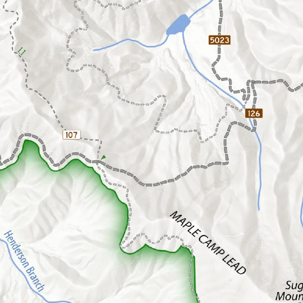
• USFS trail system and unmaintained footways
• USFS parking areas and access points
• USFS camping areas
• Waterfall locations
Information displayed on this map is a general representation of a particular geographic area and intended solely for general reference use. This map is not intended to provide precise or accurate dimensions, portrayals, geographic features, or any other data. The data used to create this graphic illustration is subject to change without notice. You are solely responsible for your safety.
Product Information
Product Information
Shipping & Returns
Shipping & Returns


Slickrock - Citico Creek Wilderness - Fly Field Guides
Slickrock - Citico Creek Wilderness - Fly Field Guides
Straddling the Tennessee-North Carolina state line southwest of Great Smoky Mountains National Park is one of the east’s best-known wilderness areas, thanks in part to its 6,000 acres of rare old-growth cove hardwood forest.
The adjoining Citico Creek and Joyce Kilmer-Slickrock wilderness areas encompass more than 35,000 acres and are ringed by popular front-country facilities and car-accessible camping areas. Popular with hikers, horseback riders, anglers, and day-trippers, the area provides plenty of space to find solitude on the trail or stream.
Nestled within the wilderness areas, the 3,800-acre Joyce Kilmer Memorial Forest draws tens of thousands of visitors each year to its easy-to-walk trails through undisturbed forest.
Adjacent to the wilderness areas lie another 10,600 acres of designated roadless areas that offer additional backcountry to explore.
Map Features
• USFS trail system and unmaintained footways
• USFS parking areas and access points
• USFS camping areas
• Waterfall locations
Information displayed on this map is a general representation of a particular geographic area and intended solely for general reference use. This map is not intended to provide precise or accurate dimensions, portrayals, geographic features, or any other data. The data used to create this graphic illustration is subject to change without notice. You are solely responsible for your safety.
$1.99
Slickrock - Citico Creek Wilderness - Fly Field Guides—
$1.99
Product Information
Product Information
Shipping & Returns
Shipping & Returns
Description
Straddling the Tennessee-North Carolina state line southwest of Great Smoky Mountains National Park is one of the east’s best-known wilderness areas, thanks in part to its 6,000 acres of rare old-growth cove hardwood forest.
The adjoining Citico Creek and Joyce Kilmer-Slickrock wilderness areas encompass more than 35,000 acres and are ringed by popular front-country facilities and car-accessible camping areas. Popular with hikers, horseback riders, anglers, and day-trippers, the area provides plenty of space to find solitude on the trail or stream.
Nestled within the wilderness areas, the 3,800-acre Joyce Kilmer Memorial Forest draws tens of thousands of visitors each year to its easy-to-walk trails through undisturbed forest.
Adjacent to the wilderness areas lie another 10,600 acres of designated roadless areas that offer additional backcountry to explore.
Map Features
• USFS trail system and unmaintained footways
• USFS parking areas and access points
• USFS camping areas
• Waterfall locations
Information displayed on this map is a general representation of a particular geographic area and intended solely for general reference use. This map is not intended to provide precise or accurate dimensions, portrayals, geographic features, or any other data. The data used to create this graphic illustration is subject to change without notice. You are solely responsible for your safety.