🎉 Up to 70% Off Selected ItemsShop Sale
Silverton, CO - Exploration Map for Sightseeing
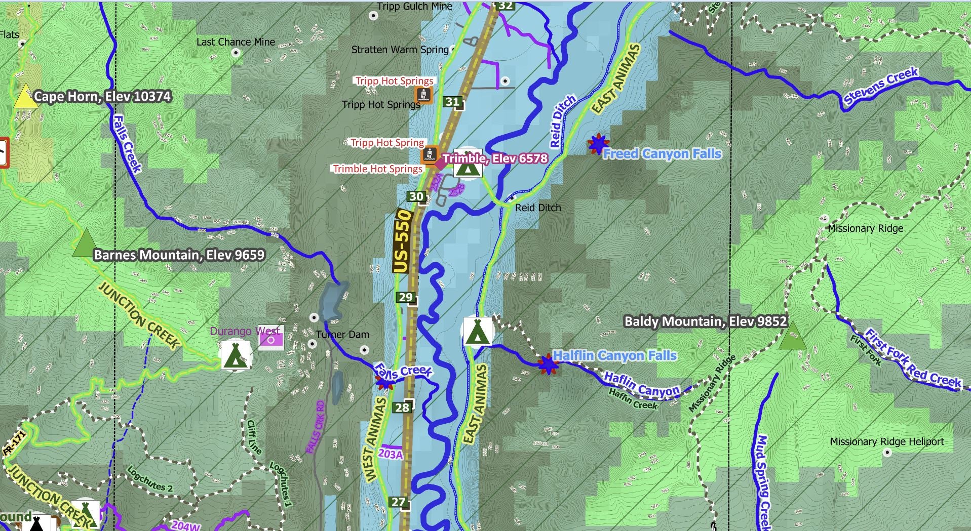
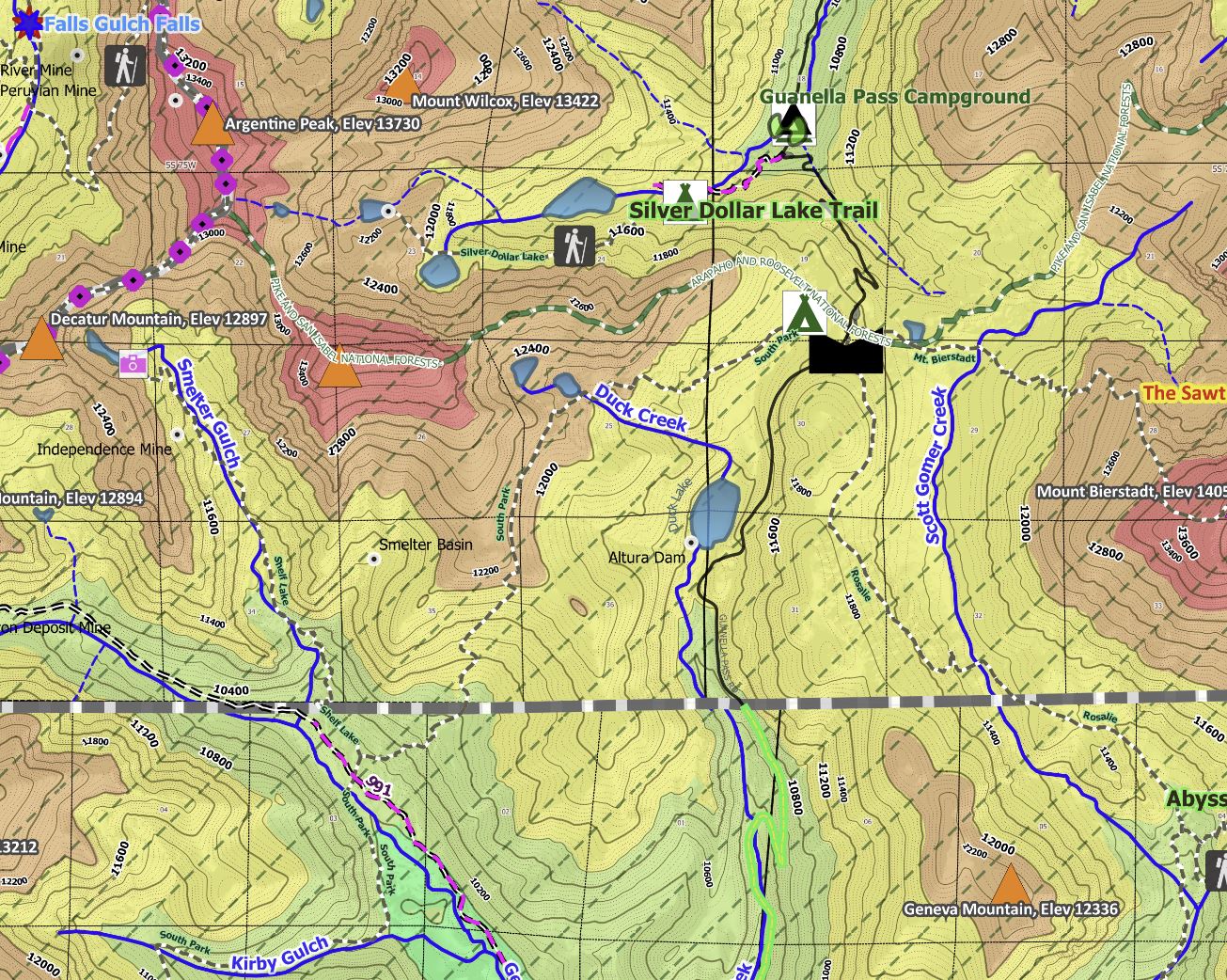
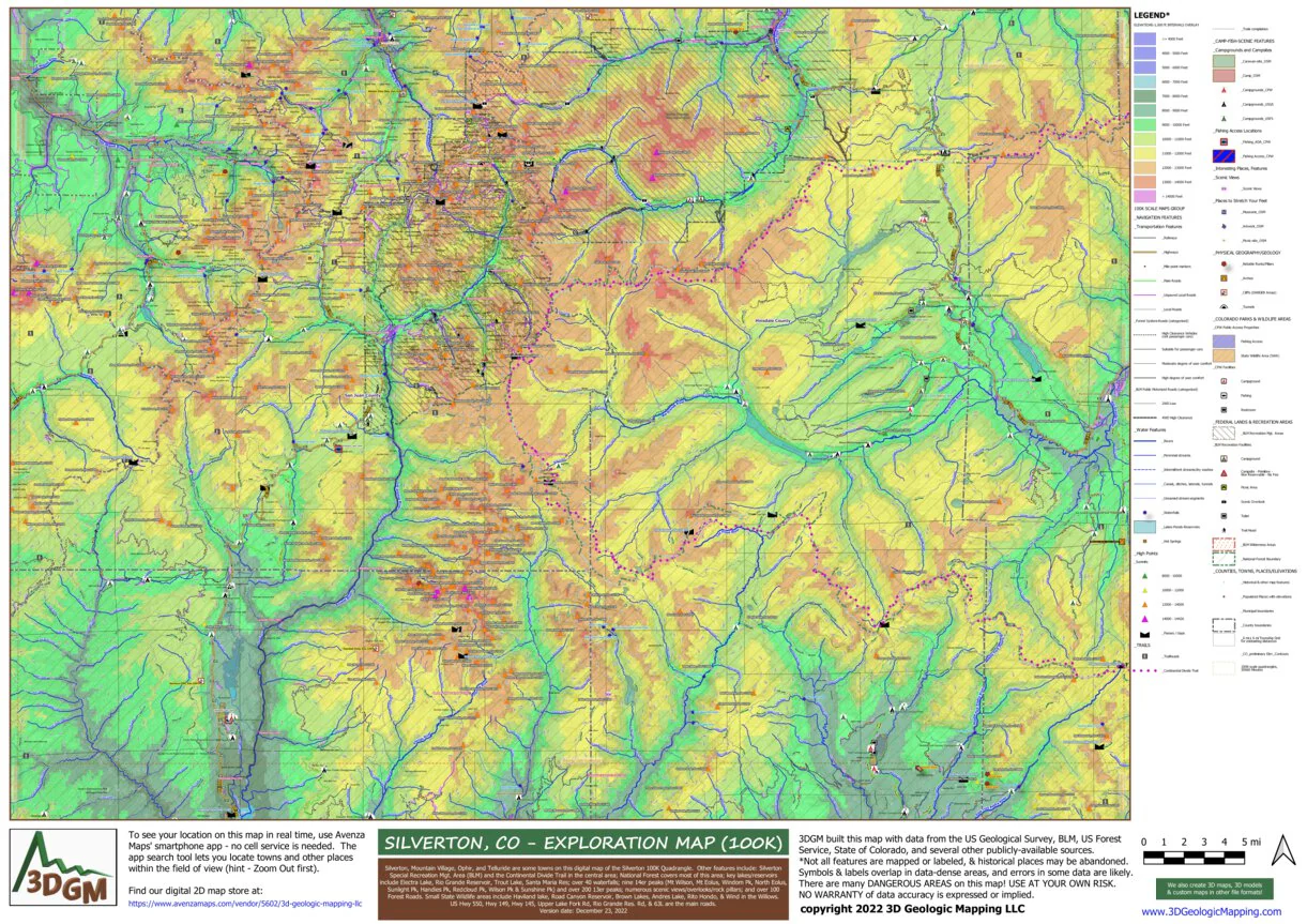
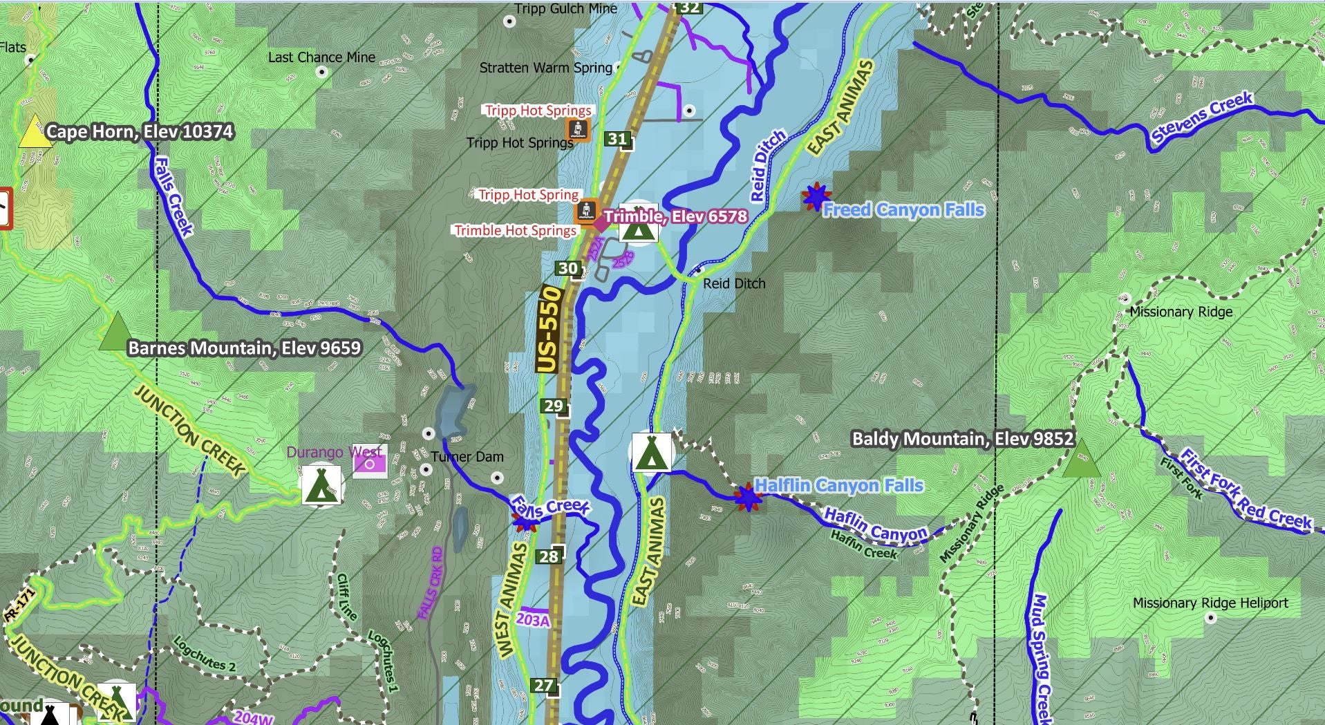
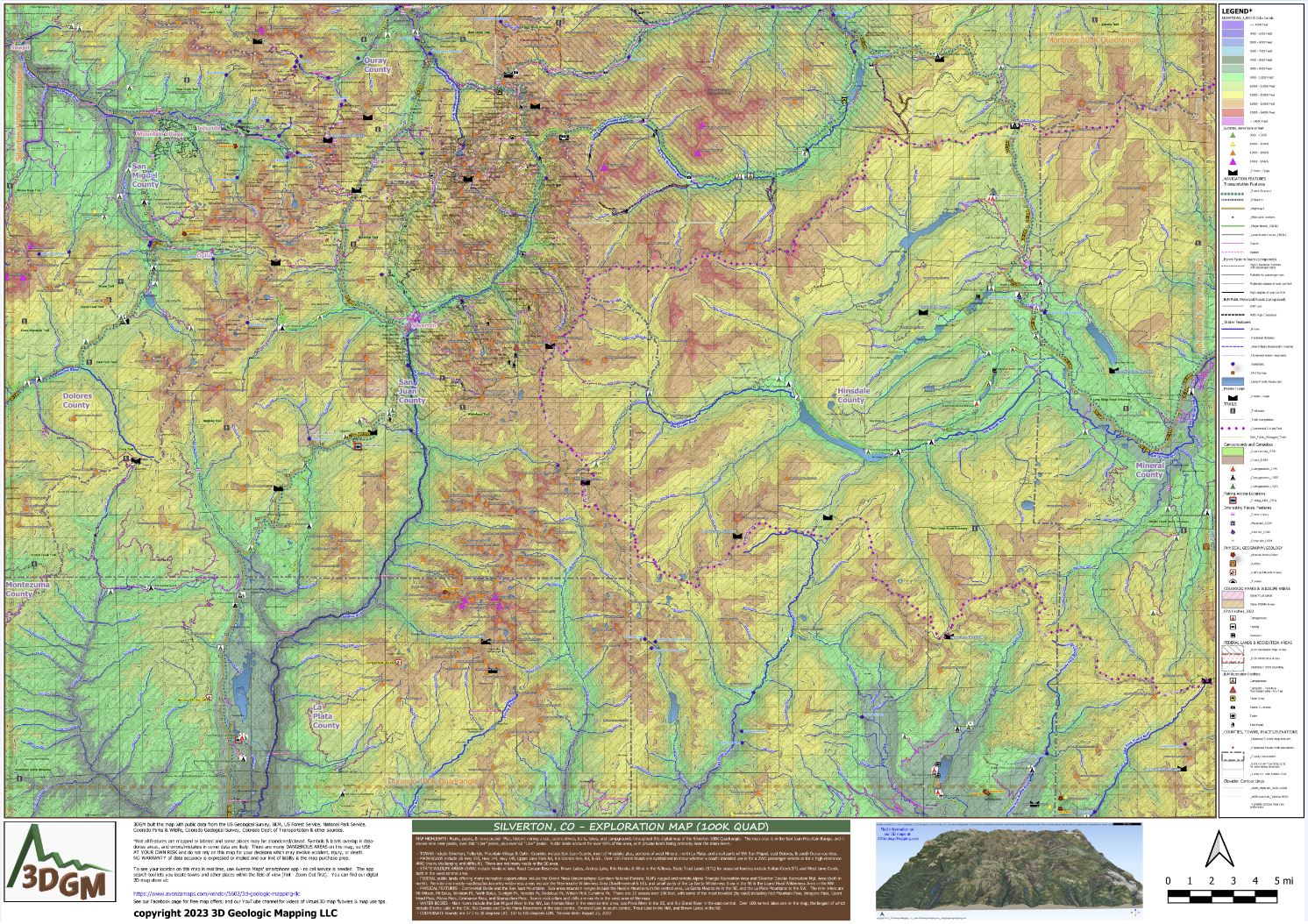
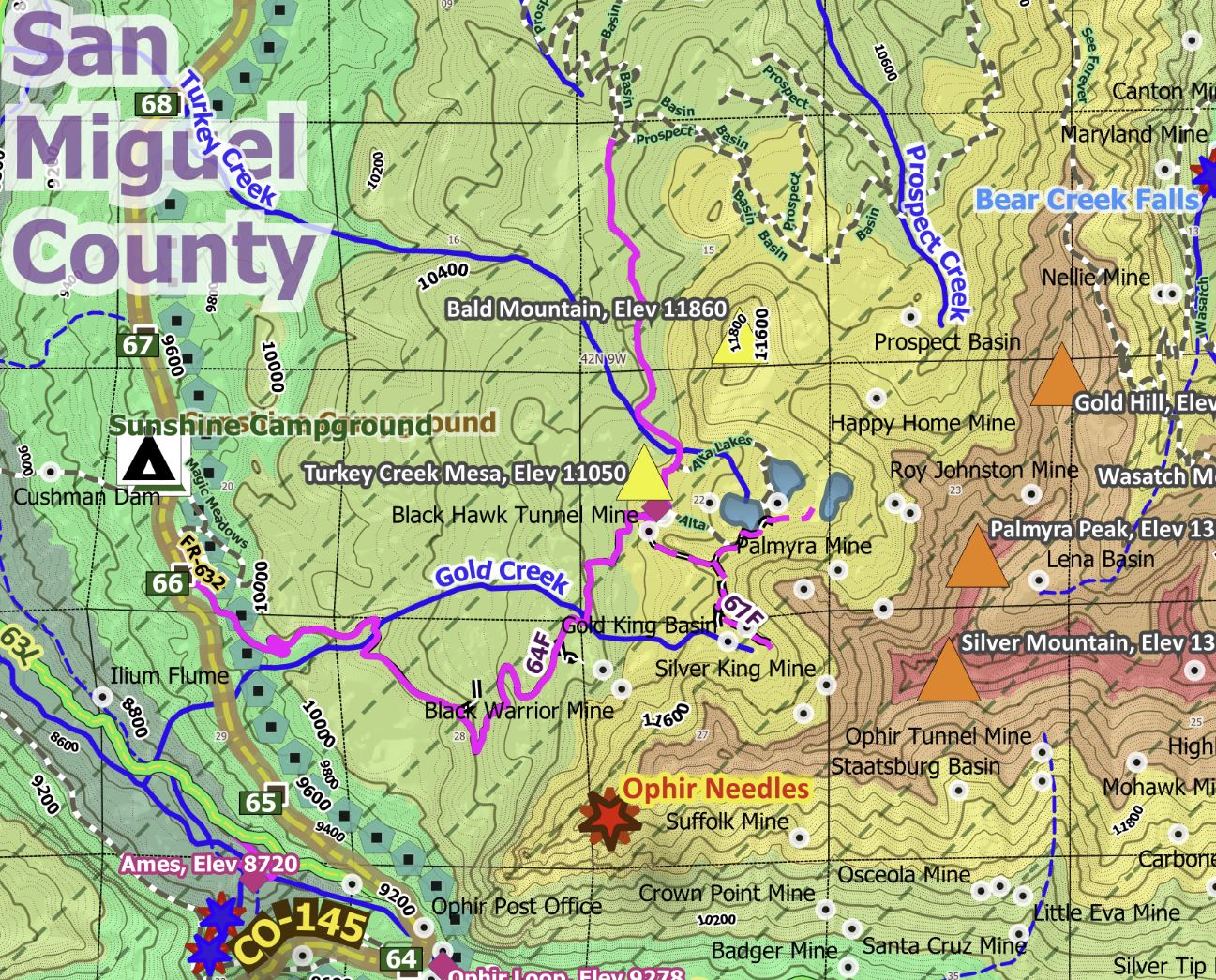
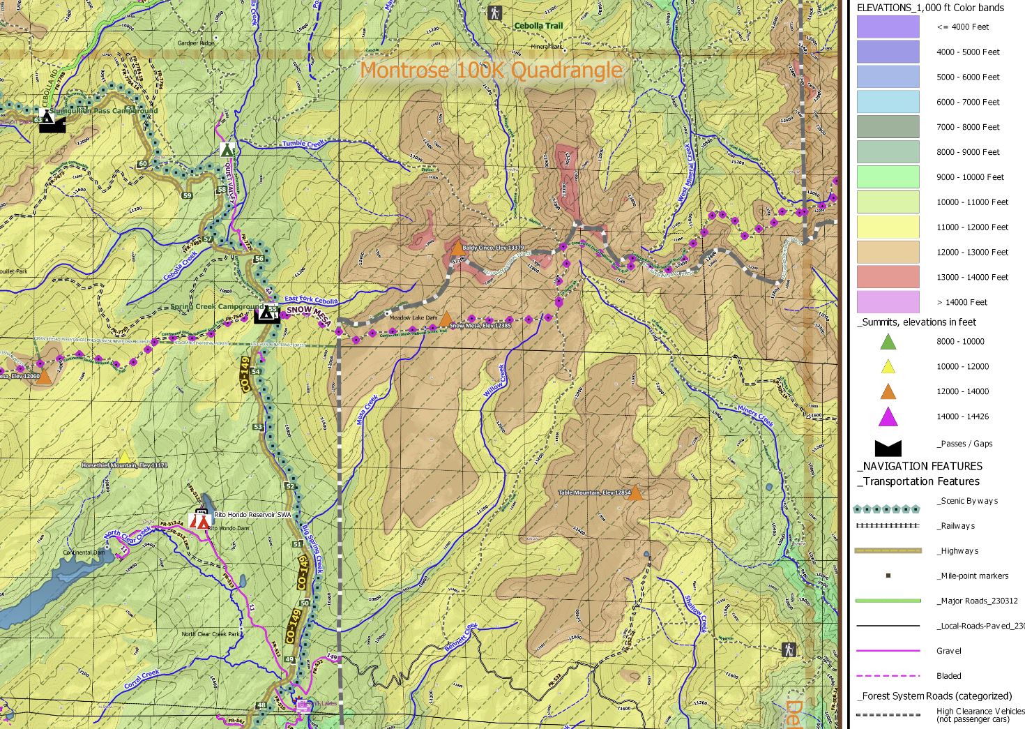
MAP HIGHLIGHTS: Peaks, peaks, & more peaks! Plus, historic mining areas, scenic drives, trails, lakes, and campgrounds throughout this digital map of the Silverton 100K Quadrangle which covers an area of 56 x 34 miles. The map area is in the San Juan Mountain Range, and it shows nine 14er peaks, over 200 “13er” peaks, plus over 60 “12er” peaks. Public lands account for over 90% of the area, with private lands being primarily near the main rivers.
- TOWNS include Silverton, Telluride, Mountain Village & Ophir. Counties include San Juan County, most of Hinsdale; plus, portions of west Mineral, north La Plata; and small parts of SW San Miguel, east Dolores, & south Ouray counties.
- MAIN ROADS include US Hwy 550, Hwy 149, Hwy 145, Upper Lake Fork Rd, Rio Grande Res. Rd, & 63L. Over 100 Forest Roads are symbolized to show whether a road's intended use is for a 2WD passenger vehicle or for a high-clearance 4WD (many challenging and difficult!). There are not many roads in the SE area.
- STATE WILDLIFE AREAS (SWA) include Haviland lake, Road Canyon Reservoir, Brown Lakes, Andres Lake, Rito Hondo, & Wind in the Willows. State Trust Lands (STL) for seasonal hunting include Sultan Creek STL and West Lime Creek, both in the west-central area.
- FEDERAL public lands offering many recreation opportunities include the Grand Mesa-Uncompahgre-Gunnison National Forests; BLM’s rugged and remote Alpine Triangle Recreation Area and Silverton Special Recreation Mgt. Area (both in north). Remote and mostly-roadless/backcountry wilderness areas include the Weminuche Wilderness Area (South-central & SE), and small parts of the La Garita Wilderness Area in the NE & the Lizard Head Wilderness Area in the NW.
- PHYSICAL FEATURES - Continental Divide and the San Juan Mountains. Sub-area mountain ranges include the Needle Mountains in the central area, La Garita Mountains in the NE, and the La Plata Mountains to the SW. The nine 14ers are Mt Wilson, Mt Eolus, Windom Pk, North Eolus, Sunlight Pk, Handies Pk, Redcloud Pk, Wilson Pk & Sunshine Pk. There are 25 passes over 10K feet, with some of the most traveled (by road) including Red Mountain Pass, Imogene Pass, Lizard Head Pass, Molas Pass, Cimmaron Pass, and Slumgullion Pass. Scenic rock pillars and cliffs are mainly in the west area of the map.
- WATER BODIES - Main rivers include the San Miguel River in the NW, Las Animas River in the west-central area, Los Pinos River in the SE, and Rio Grand River in the east-central. Over 100 named lakes are on the map, the largest of which include Electra Lake in the SW, Rio Grande and Santa Maria Reservoirs in the east-central, Emerald Lake in south-central, Trout Lake in the NW, and Brown Lakes in the NE. And, over 40 waterfalls.
- COORDINATE bounds are 37.5 to 38 degrees LAT, 107 to 108 degrees LON. Version date: August 25, 2023
Product Information
Product Information
Shipping & Returns
Shipping & Returns
Silverton, CO - Exploration Map for Sightseeing
Silverton, CO - Exploration Map for Sightseeing
MAP HIGHLIGHTS: Peaks, peaks, & more peaks! Plus, historic mining areas, scenic drives, trails, lakes, and campgrounds throughout this digital map of the Silverton 100K Quadrangle which covers an area of 56 x 34 miles. The map area is in the San Juan Mountain Range, and it shows nine 14er peaks, over 200 “13er” peaks, plus over 60 “12er” peaks. Public lands account for over 90% of the area, with private lands being primarily near the main rivers.
- TOWNS include Silverton, Telluride, Mountain Village & Ophir. Counties include San Juan County, most of Hinsdale; plus, portions of west Mineral, north La Plata; and small parts of SW San Miguel, east Dolores, & south Ouray counties.
- MAIN ROADS include US Hwy 550, Hwy 149, Hwy 145, Upper Lake Fork Rd, Rio Grande Res. Rd, & 63L. Over 100 Forest Roads are symbolized to show whether a road's intended use is for a 2WD passenger vehicle or for a high-clearance 4WD (many challenging and difficult!). There are not many roads in the SE area.
- STATE WILDLIFE AREAS (SWA) include Haviland lake, Road Canyon Reservoir, Brown Lakes, Andres Lake, Rito Hondo, & Wind in the Willows. State Trust Lands (STL) for seasonal hunting include Sultan Creek STL and West Lime Creek, both in the west-central area.
- FEDERAL public lands offering many recreation opportunities include the Grand Mesa-Uncompahgre-Gunnison National Forests; BLM’s rugged and remote Alpine Triangle Recreation Area and Silverton Special Recreation Mgt. Area (both in north). Remote and mostly-roadless/backcountry wilderness areas include the Weminuche Wilderness Area (South-central & SE), and small parts of the La Garita Wilderness Area in the NE & the Lizard Head Wilderness Area in the NW.
- PHYSICAL FEATURES - Continental Divide and the San Juan Mountains. Sub-area mountain ranges include the Needle Mountains in the central area, La Garita Mountains in the NE, and the La Plata Mountains to the SW. The nine 14ers are Mt Wilson, Mt Eolus, Windom Pk, North Eolus, Sunlight Pk, Handies Pk, Redcloud Pk, Wilson Pk & Sunshine Pk. There are 25 passes over 10K feet, with some of the most traveled (by road) including Red Mountain Pass, Imogene Pass, Lizard Head Pass, Molas Pass, Cimmaron Pass, and Slumgullion Pass. Scenic rock pillars and cliffs are mainly in the west area of the map.
- WATER BODIES - Main rivers include the San Miguel River in the NW, Las Animas River in the west-central area, Los Pinos River in the SE, and Rio Grand River in the east-central. Over 100 named lakes are on the map, the largest of which include Electra Lake in the SW, Rio Grande and Santa Maria Reservoirs in the east-central, Emerald Lake in south-central, Trout Lake in the NW, and Brown Lakes in the NE. And, over 40 waterfalls.
- COORDINATE bounds are 37.5 to 38 degrees LAT, 107 to 108 degrees LON. Version date: August 25, 2023
$1.75
Original: $4.99
-65%Silverton, CO - Exploration Map for Sightseeing—
$4.99
$1.75Product Information
Product Information
Shipping & Returns
Shipping & Returns
Description
MAP HIGHLIGHTS: Peaks, peaks, & more peaks! Plus, historic mining areas, scenic drives, trails, lakes, and campgrounds throughout this digital map of the Silverton 100K Quadrangle which covers an area of 56 x 34 miles. The map area is in the San Juan Mountain Range, and it shows nine 14er peaks, over 200 “13er” peaks, plus over 60 “12er” peaks. Public lands account for over 90% of the area, with private lands being primarily near the main rivers.
- TOWNS include Silverton, Telluride, Mountain Village & Ophir. Counties include San Juan County, most of Hinsdale; plus, portions of west Mineral, north La Plata; and small parts of SW San Miguel, east Dolores, & south Ouray counties.
- MAIN ROADS include US Hwy 550, Hwy 149, Hwy 145, Upper Lake Fork Rd, Rio Grande Res. Rd, & 63L. Over 100 Forest Roads are symbolized to show whether a road's intended use is for a 2WD passenger vehicle or for a high-clearance 4WD (many challenging and difficult!). There are not many roads in the SE area.
- STATE WILDLIFE AREAS (SWA) include Haviland lake, Road Canyon Reservoir, Brown Lakes, Andres Lake, Rito Hondo, & Wind in the Willows. State Trust Lands (STL) for seasonal hunting include Sultan Creek STL and West Lime Creek, both in the west-central area.
- FEDERAL public lands offering many recreation opportunities include the Grand Mesa-Uncompahgre-Gunnison National Forests; BLM’s rugged and remote Alpine Triangle Recreation Area and Silverton Special Recreation Mgt. Area (both in north). Remote and mostly-roadless/backcountry wilderness areas include the Weminuche Wilderness Area (South-central & SE), and small parts of the La Garita Wilderness Area in the NE & the Lizard Head Wilderness Area in the NW.
- PHYSICAL FEATURES - Continental Divide and the San Juan Mountains. Sub-area mountain ranges include the Needle Mountains in the central area, La Garita Mountains in the NE, and the La Plata Mountains to the SW. The nine 14ers are Mt Wilson, Mt Eolus, Windom Pk, North Eolus, Sunlight Pk, Handies Pk, Redcloud Pk, Wilson Pk & Sunshine Pk. There are 25 passes over 10K feet, with some of the most traveled (by road) including Red Mountain Pass, Imogene Pass, Lizard Head Pass, Molas Pass, Cimmaron Pass, and Slumgullion Pass. Scenic rock pillars and cliffs are mainly in the west area of the map.
- WATER BODIES - Main rivers include the San Miguel River in the NW, Las Animas River in the west-central area, Los Pinos River in the SE, and Rio Grand River in the east-central. Over 100 named lakes are on the map, the largest of which include Electra Lake in the SW, Rio Grande and Santa Maria Reservoirs in the east-central, Emerald Lake in south-central, Trout Lake in the NW, and Brown Lakes in the NE. And, over 40 waterfalls.
- COORDINATE bounds are 37.5 to 38 degrees LAT, 107 to 108 degrees LON. Version date: August 25, 2023