🎉 Up to 70% Off Selected ItemsShop Sale
Glenwood Springs Exploration Map for Sightseeing
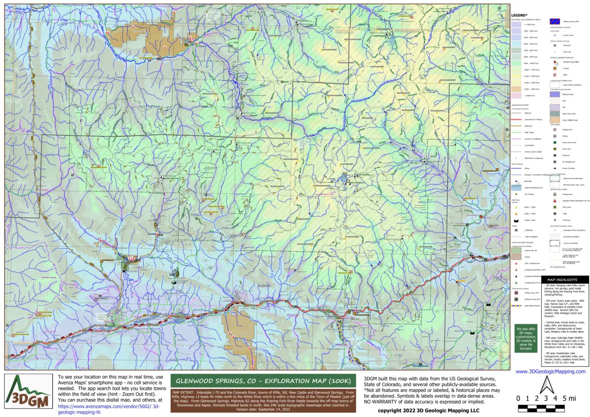
This map for the Glenwood Springs 100K Quadrangle covers a 60-mile length of Interstate I-70 situated along the Colorado River. Towns include Glenwood Springs, New Castle, Silt, and Rifle. From Rifle, Highway 13 leads 40 miles north to the White River which is within a few miles of the Town of Meeker (just off the map). From Glenwood Springs, Highway 82 extends southeast along the Roaring Fork River heading towards the off-map towns of Snowmass and Aspen. Popular Hanging Lake is in the southeast. Remote forested lands, forest roads as well as roadless lands with trails are in north. Map highlights include:
- SE area: Hanging Lake Falls, scenic canyons, hot springs, gold medal fishing along the Roaring Fork River, camping/fishing.
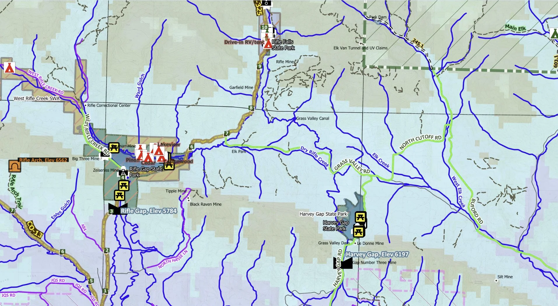
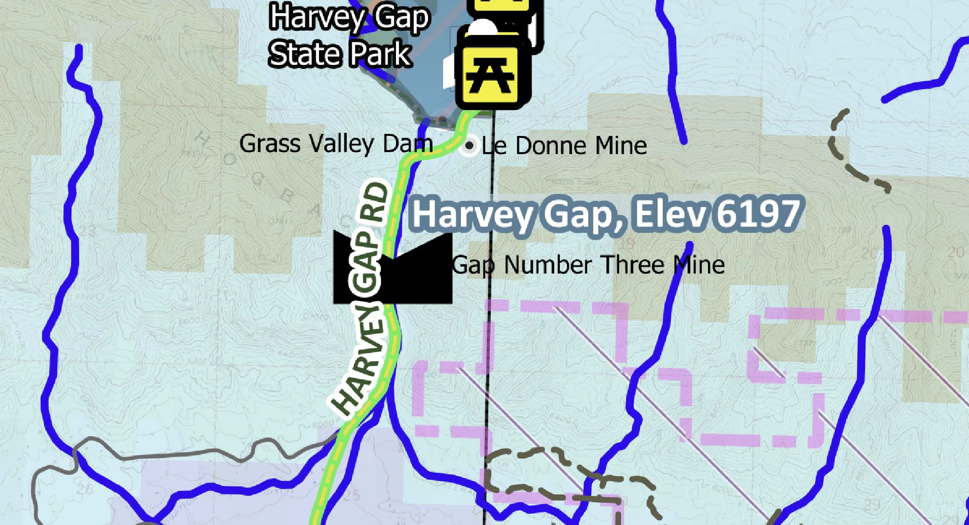
- SW area: Scenic state parks: Rifle Gap, Harvey Gap S.P., and Rifle Falls. Campsites at Garfield Creek wildlife area. Several cliffs (be careful). Rifle Heritage Center and Museum.
- Central area: Forest lands & roads, trails, cliffs, and backcountry campsites. Campgrounds at Heart Lake, Meadow Lake & smaller lakes.
- NW area: Oakridge State Wildlife Area, campgrounds and trails in the White River Valley and its tributaries. Elevations from 6K+ to 10K+ feet.
- NE area: Sweetwater Lake Campground, waterfalls, trails, and remote, mostly roadless forest lands. Peaks of 11K to 12K+ feet.
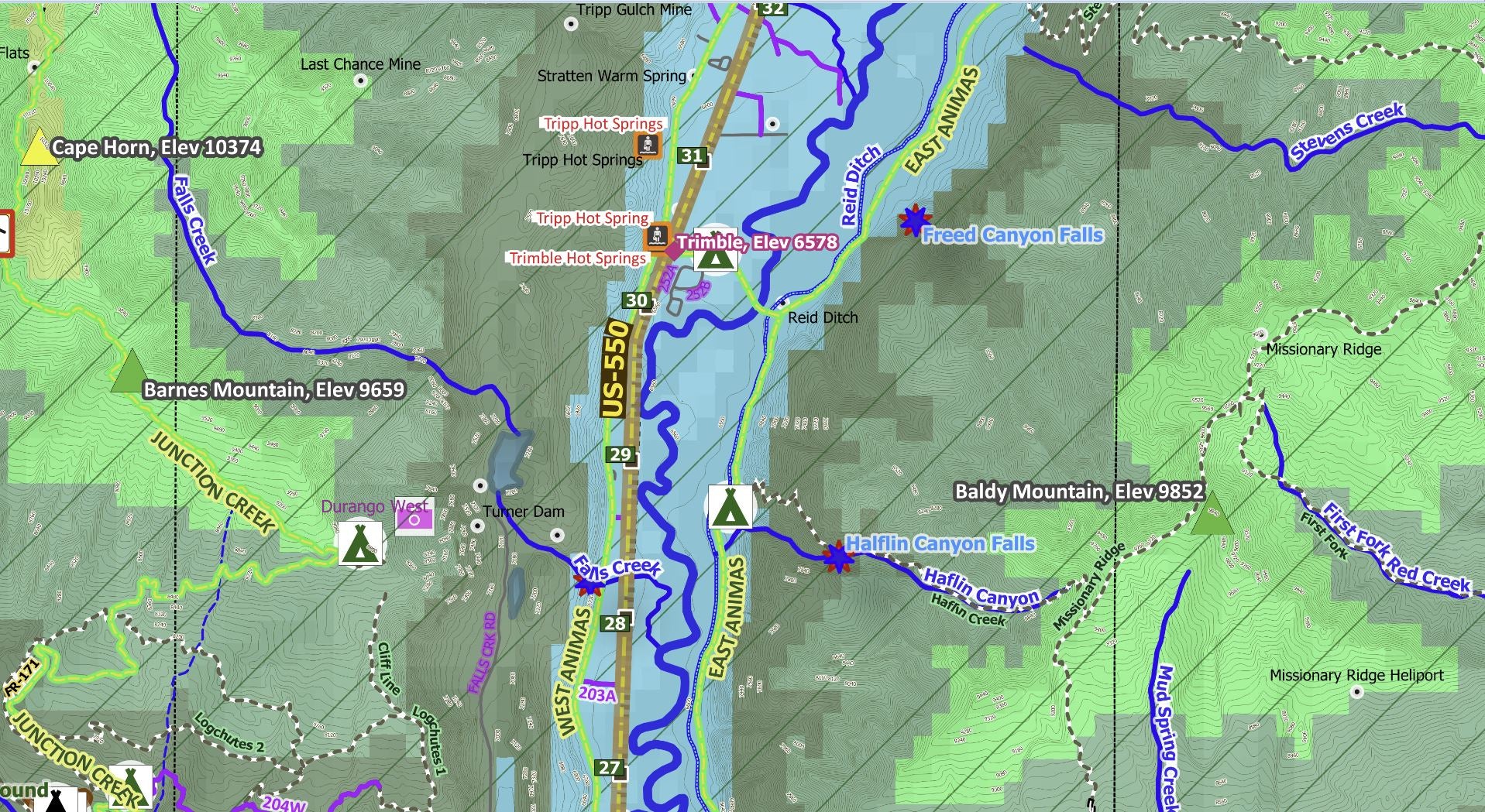
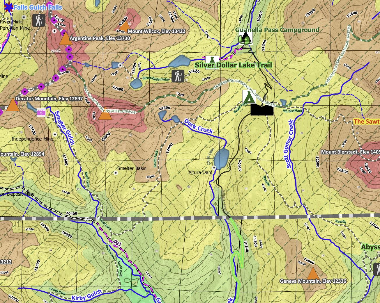
Detailed 24K topographic maps can be seen when zoomed in to a few square miles! The Avenza Maps smartphone app lets you see your location as you move around in the map area, set a location pin to find your way back to your car or campsite, track your path in real-time, and more!
Other features mapped include trailheads, scenic view spots, streams, waterfalls, interesting geologic features (notable rock formations, arches, cliffs, tunnels), interstates/highways with mile markers, main/secondary/local roads, notable amenities on public lands (picnic areas, restrooms); and boundaries of State Parks/other State lands, National Forests, and BLM lands/campsites.
Product Information
Product Information
Shipping & Returns
Shipping & Returns
Glenwood Springs Exploration Map for Sightseeing
Glenwood Springs Exploration Map for Sightseeing
This map for the Glenwood Springs 100K Quadrangle covers a 60-mile length of Interstate I-70 situated along the Colorado River. Towns include Glenwood Springs, New Castle, Silt, and Rifle. From Rifle, Highway 13 leads 40 miles north to the White River which is within a few miles of the Town of Meeker (just off the map). From Glenwood Springs, Highway 82 extends southeast along the Roaring Fork River heading towards the off-map towns of Snowmass and Aspen. Popular Hanging Lake is in the southeast. Remote forested lands, forest roads as well as roadless lands with trails are in north. Map highlights include:
- SE area: Hanging Lake Falls, scenic canyons, hot springs, gold medal fishing along the Roaring Fork River, camping/fishing.
- SW area: Scenic state parks: Rifle Gap, Harvey Gap S.P., and Rifle Falls. Campsites at Garfield Creek wildlife area. Several cliffs (be careful). Rifle Heritage Center and Museum.
- Central area: Forest lands & roads, trails, cliffs, and backcountry campsites. Campgrounds at Heart Lake, Meadow Lake & smaller lakes.
- NW area: Oakridge State Wildlife Area, campgrounds and trails in the White River Valley and its tributaries. Elevations from 6K+ to 10K+ feet.
- NE area: Sweetwater Lake Campground, waterfalls, trails, and remote, mostly roadless forest lands. Peaks of 11K to 12K+ feet.
Detailed 24K topographic maps can be seen when zoomed in to a few square miles! The Avenza Maps smartphone app lets you see your location as you move around in the map area, set a location pin to find your way back to your car or campsite, track your path in real-time, and more!
Other features mapped include trailheads, scenic view spots, streams, waterfalls, interesting geologic features (notable rock formations, arches, cliffs, tunnels), interstates/highways with mile markers, main/secondary/local roads, notable amenities on public lands (picnic areas, restrooms); and boundaries of State Parks/other State lands, National Forests, and BLM lands/campsites.
$4.99
Glenwood Springs Exploration Map for Sightseeing—
$4.99
Product Information
Product Information
Shipping & Returns
Shipping & Returns
Description
This map for the Glenwood Springs 100K Quadrangle covers a 60-mile length of Interstate I-70 situated along the Colorado River. Towns include Glenwood Springs, New Castle, Silt, and Rifle. From Rifle, Highway 13 leads 40 miles north to the White River which is within a few miles of the Town of Meeker (just off the map). From Glenwood Springs, Highway 82 extends southeast along the Roaring Fork River heading towards the off-map towns of Snowmass and Aspen. Popular Hanging Lake is in the southeast. Remote forested lands, forest roads as well as roadless lands with trails are in north. Map highlights include:
- SE area: Hanging Lake Falls, scenic canyons, hot springs, gold medal fishing along the Roaring Fork River, camping/fishing.
- SW area: Scenic state parks: Rifle Gap, Harvey Gap S.P., and Rifle Falls. Campsites at Garfield Creek wildlife area. Several cliffs (be careful). Rifle Heritage Center and Museum.
- Central area: Forest lands & roads, trails, cliffs, and backcountry campsites. Campgrounds at Heart Lake, Meadow Lake & smaller lakes.
- NW area: Oakridge State Wildlife Area, campgrounds and trails in the White River Valley and its tributaries. Elevations from 6K+ to 10K+ feet.
- NE area: Sweetwater Lake Campground, waterfalls, trails, and remote, mostly roadless forest lands. Peaks of 11K to 12K+ feet.
Detailed 24K topographic maps can be seen when zoomed in to a few square miles! The Avenza Maps smartphone app lets you see your location as you move around in the map area, set a location pin to find your way back to your car or campsite, track your path in real-time, and more!
Other features mapped include trailheads, scenic view spots, streams, waterfalls, interesting geologic features (notable rock formations, arches, cliffs, tunnels), interstates/highways with mile markers, main/secondary/local roads, notable amenities on public lands (picnic areas, restrooms); and boundaries of State Parks/other State lands, National Forests, and BLM lands/campsites.