🎉 Up to 70% Off Selected ItemsShop Sale
La Junta, CO Topographic Map for Navigation and Recreation (250K Quad)
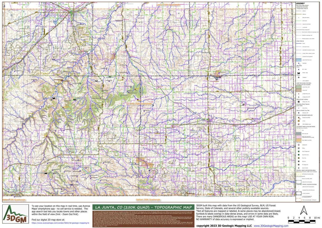
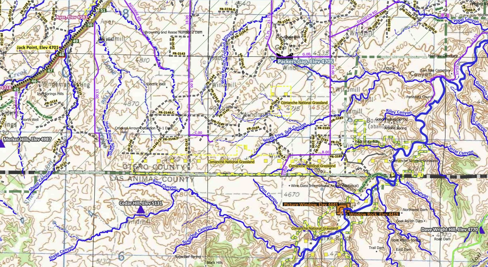
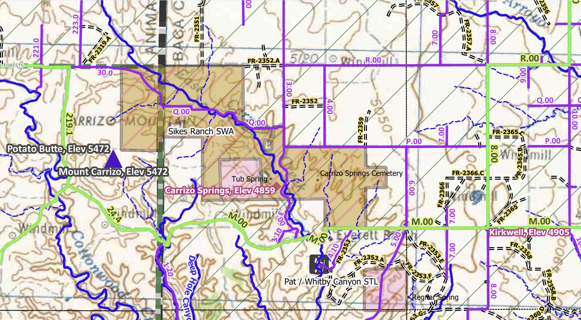
This La Junta 250K Quadrangle Topographic Map for navigation/recreation in SE Colorado (37 to 38 degrees LAT, 102 to 104 degrees LON) covers over 7,000 sq mi of rural, US Forest Service lands & state lands.
Seasonal camping is mapped at Chancellor Park Ranch state trust land (STL) and unnamed locations within the Pike and San Isabel National Forests in the southern and northwestern areas of the map. US Forest Service roads extend over the mapped lands in the Pike and San Isabel National Forests.
Commanche National Grasslands are in the northwest area. Physical features of interest (cliffs, buttes, rock pillars) are mainly in the central and western side of the area.
State trust lands for seasonal hunting include Higbee Canyon STL, North Canyon, Sand Creek South, State Line, Pat Canyon/Whitby. Refer to https://cpw.state.co.us/thingstodo/Pages/Outdoor-Recreation.aspx
Key water bodies consist of the Purgatorie River/State Wildlife Area (SWA) in the northwest and the North Fork of the Cimmaron River and the Cimmaron River are in the southeast. Reservoirs and lakes include Two Buttes Res., Crooked Arroyo Res. No 1 and 2, Prairie Lake, Brown Res., Swink Res. No 1, 2, and 5; Turks Pond, Heinan Lake, Denny Lake, Reader Lake, and Burchfield Lake.
Primary State Wildlife Areas include Two Buttes Reservoir SWA, Burchfield SWA, Setchfield SWA, Timpas Creek SWA, Purgatoire River SWA, Turk’s Pond SWA, and Sikes Ranch SWA/STL.
Counties (and portions thereof) include Baca, southwest Otero, east Las Animas, south Bent & south Prowers. Towns include La Junta, Branson, Campo, Kim, Pritchett, Springfield, Swink, Two Buttes, Vilas & Walsh.
Main roads on this map are US Hwy 50, US Hwy 160, US Hwy 287, US Hwy 350, Hwy 59, Hwy 71, Hwy 89, Hwy 101, Hwy 109, Hwy 116, Hwy 194, and Hwy 389; and county roads (CR) 10, 11, 12, 18, 28, 36, 44, 45, BB, CC, D, FF, J, JJ, M, N, RR, TTT, X, and Y.
Product Information
Product Information
Shipping & Returns
Shipping & Returns
La Junta, CO Topographic Map for Navigation and Recreation (250K Quad)
La Junta, CO Topographic Map for Navigation and Recreation (250K Quad)
This La Junta 250K Quadrangle Topographic Map for navigation/recreation in SE Colorado (37 to 38 degrees LAT, 102 to 104 degrees LON) covers over 7,000 sq mi of rural, US Forest Service lands & state lands.
Seasonal camping is mapped at Chancellor Park Ranch state trust land (STL) and unnamed locations within the Pike and San Isabel National Forests in the southern and northwestern areas of the map. US Forest Service roads extend over the mapped lands in the Pike and San Isabel National Forests.
Commanche National Grasslands are in the northwest area. Physical features of interest (cliffs, buttes, rock pillars) are mainly in the central and western side of the area.
State trust lands for seasonal hunting include Higbee Canyon STL, North Canyon, Sand Creek South, State Line, Pat Canyon/Whitby. Refer to https://cpw.state.co.us/thingstodo/Pages/Outdoor-Recreation.aspx
Key water bodies consist of the Purgatorie River/State Wildlife Area (SWA) in the northwest and the North Fork of the Cimmaron River and the Cimmaron River are in the southeast. Reservoirs and lakes include Two Buttes Res., Crooked Arroyo Res. No 1 and 2, Prairie Lake, Brown Res., Swink Res. No 1, 2, and 5; Turks Pond, Heinan Lake, Denny Lake, Reader Lake, and Burchfield Lake.
Primary State Wildlife Areas include Two Buttes Reservoir SWA, Burchfield SWA, Setchfield SWA, Timpas Creek SWA, Purgatoire River SWA, Turk’s Pond SWA, and Sikes Ranch SWA/STL.
Counties (and portions thereof) include Baca, southwest Otero, east Las Animas, south Bent & south Prowers. Towns include La Junta, Branson, Campo, Kim, Pritchett, Springfield, Swink, Two Buttes, Vilas & Walsh.
Main roads on this map are US Hwy 50, US Hwy 160, US Hwy 287, US Hwy 350, Hwy 59, Hwy 71, Hwy 89, Hwy 101, Hwy 109, Hwy 116, Hwy 194, and Hwy 389; and county roads (CR) 10, 11, 12, 18, 28, 36, 44, 45, BB, CC, D, FF, J, JJ, M, N, RR, TTT, X, and Y.
$4.99
La Junta, CO Topographic Map for Navigation and Recreation (250K Quad)—
$4.99
Product Information
Product Information
Shipping & Returns
Shipping & Returns
Description
This La Junta 250K Quadrangle Topographic Map for navigation/recreation in SE Colorado (37 to 38 degrees LAT, 102 to 104 degrees LON) covers over 7,000 sq mi of rural, US Forest Service lands & state lands.
Seasonal camping is mapped at Chancellor Park Ranch state trust land (STL) and unnamed locations within the Pike and San Isabel National Forests in the southern and northwestern areas of the map. US Forest Service roads extend over the mapped lands in the Pike and San Isabel National Forests.
Commanche National Grasslands are in the northwest area. Physical features of interest (cliffs, buttes, rock pillars) are mainly in the central and western side of the area.
State trust lands for seasonal hunting include Higbee Canyon STL, North Canyon, Sand Creek South, State Line, Pat Canyon/Whitby. Refer to https://cpw.state.co.us/thingstodo/Pages/Outdoor-Recreation.aspx
Key water bodies consist of the Purgatorie River/State Wildlife Area (SWA) in the northwest and the North Fork of the Cimmaron River and the Cimmaron River are in the southeast. Reservoirs and lakes include Two Buttes Res., Crooked Arroyo Res. No 1 and 2, Prairie Lake, Brown Res., Swink Res. No 1, 2, and 5; Turks Pond, Heinan Lake, Denny Lake, Reader Lake, and Burchfield Lake.
Primary State Wildlife Areas include Two Buttes Reservoir SWA, Burchfield SWA, Setchfield SWA, Timpas Creek SWA, Purgatoire River SWA, Turk’s Pond SWA, and Sikes Ranch SWA/STL.
Counties (and portions thereof) include Baca, southwest Otero, east Las Animas, south Bent & south Prowers. Towns include La Junta, Branson, Campo, Kim, Pritchett, Springfield, Swink, Two Buttes, Vilas & Walsh.
Main roads on this map are US Hwy 50, US Hwy 160, US Hwy 287, US Hwy 350, Hwy 59, Hwy 71, Hwy 89, Hwy 101, Hwy 109, Hwy 116, Hwy 194, and Hwy 389; and county roads (CR) 10, 11, 12, 18, 28, 36, 44, 45, BB, CC, D, FF, J, JJ, M, N, RR, TTT, X, and Y.